
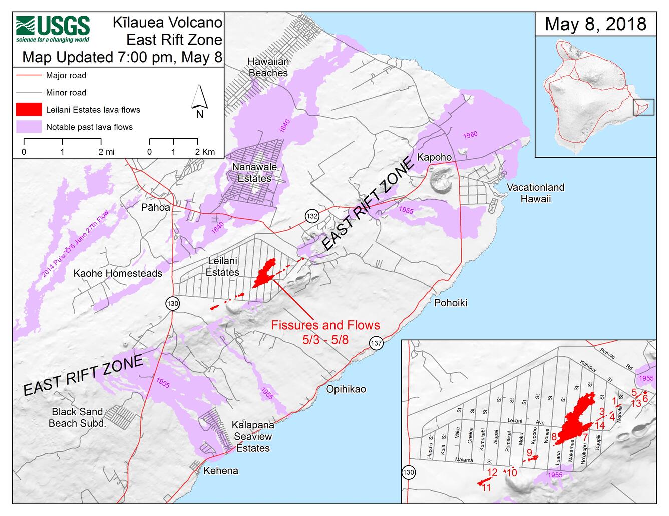
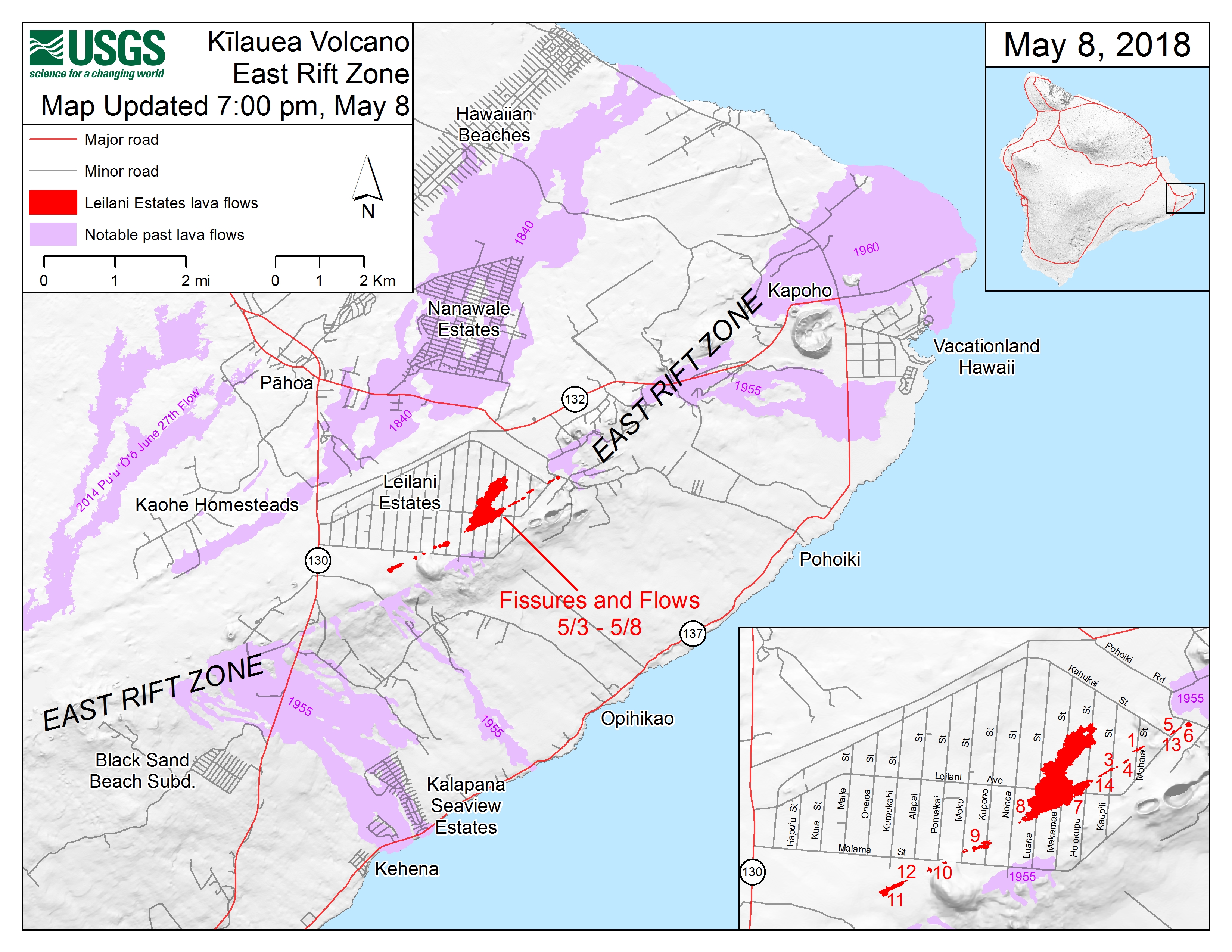
Kīlauea ERZ Fissure Map as of 7:00 p.m. , May 9
Detailed Description
This map shows the locations of fissures and an ‘A‘ā flow erupted since May 3 in the order that they occurred in Leilani Estates as of 7:00 p.m. HST, May 8. The purple areas are lava flows erupted in 1840, 1955, 1960, and 2014-2015.
Sources/Usage
Public Domain.