
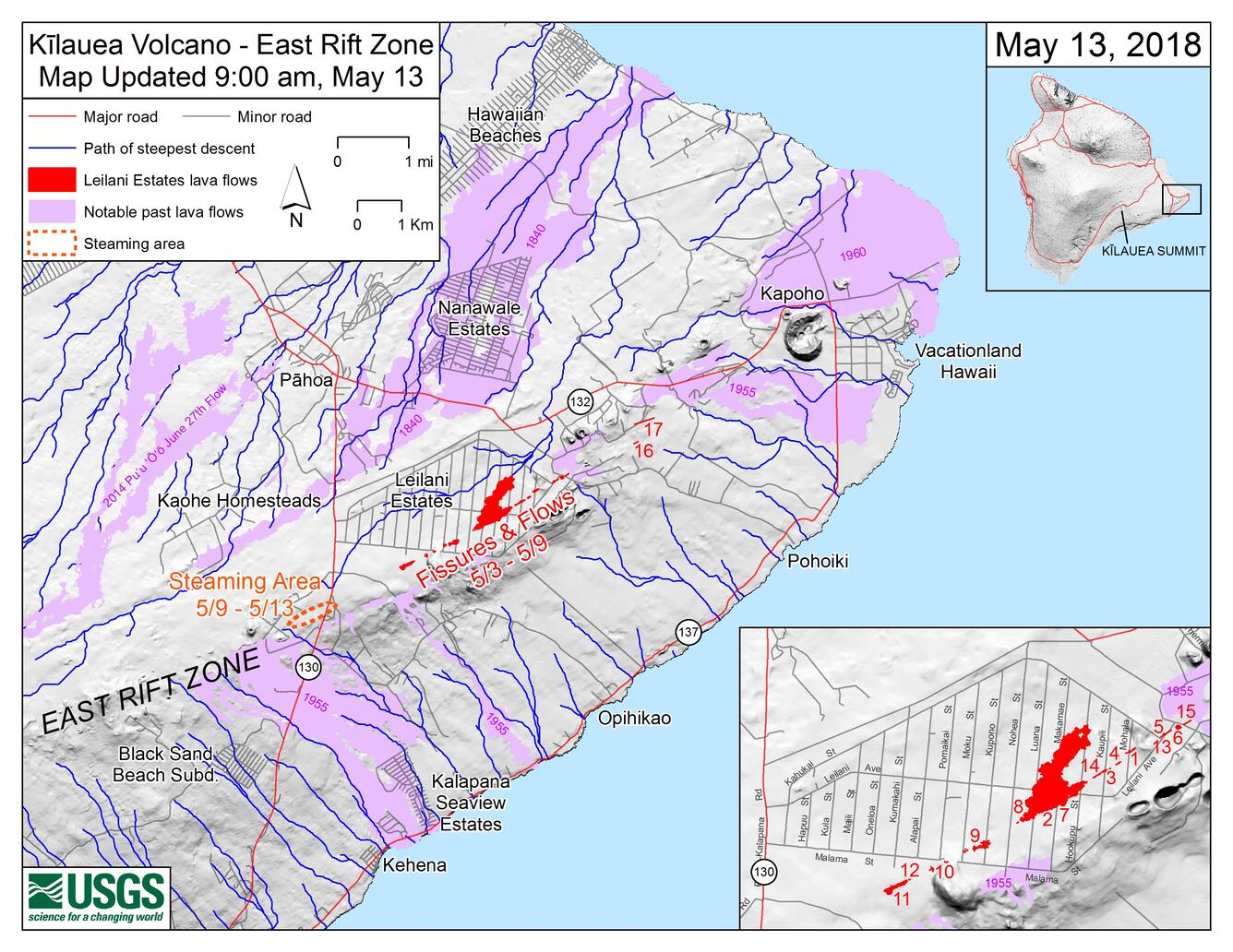
Kīlauea LERZ Fissures, May 13 at 9:00 a.m.
Detailed Description
Map as of 9:00 a.m. HST, May 13, shows the location of fissure 17, which opened this morning at approximately 4:30 a.m. HST. NOTE: This new fissure was initially referred to as fissure 18 in early reports, but that is incorrect (what was called fissure 17 yesterday did not erupt lava, so this morning's erupting fissure is actually 17). In addition to fissure 17, the map shows earlier fissures, lava flows, and steaming areas. Inset map (lower right) shows fissures in Leilani Estates in the order they occurred since May 3. Shaded purple areas indicate lava flows erupted in 1840, 1955, 1960, and 2014-2015.
Sources/Usage
Public Domain.