
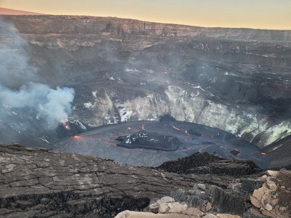
Kīlauea summit eruption - Dec. 30, 2020, at 7 a.m. HST
Detailed Description
The lava lake within Halemaʻumaʻu crater has changed little in the past few days.The most recent thermal map (Dec. 28) provided the lake dimensions as 770 by 490 m (840 by 535 yds) for a total area of 29 ha (72 acres). Over the past day, the main island of cooler, solidified lava floating in the lava lake (the raised mass visible in the center of the photo) drifted slightly to the west (left in the photo) in the lake and rotated counter-clockwise, whereas the 10 or so much smaller islands to the east (raised masses to the right of the island in the photo) remained stationary. The main island measured about 250 m (820 ft) in length, 135 m (440 ft) in width, and about 3 ha (7 acres) in area based on the Dec. 28 thermal map. Measurements on Dec. 27 show that the island surface was about 6 m (20 ft) above the lake surface. USGS photo by N. Deligne.
Sources/Usage
Public Domain.