
Kīlauea's crater lake on December 18, 2020
Detailed Description
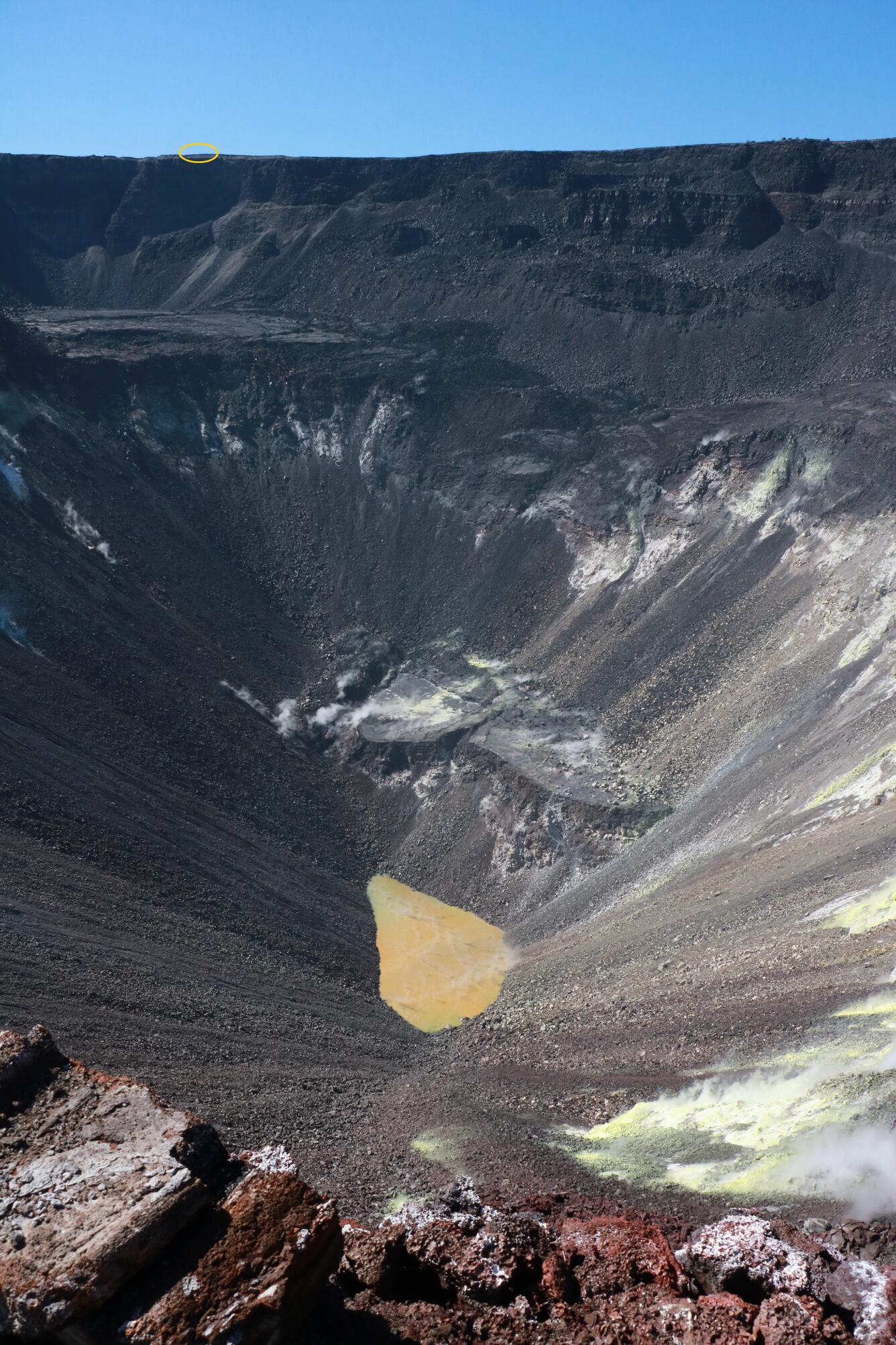
The yellow circle in the upper left corner marks where HVO scientists normally stand to make measurements of Kīlauea's summit crater lake. From that vantage point, the far west end of the lake is obscured. On December 18, HVO geologists landed on Kīlauea caldera's down-dropped block east of the crater lake, where views of the currently tear-drop-shaped lake were unobstructed. Bright yellow sulfur marks areas of ongoing fumarolic emissions through the talus lining the walls of Halema‘uma‘u. HVO fieldwork in this closed area of Hawai‘i Volcanoes National Park is done with permission of the National Park Service to support public safety and further scientific understanding of Kīlauea Volcano. USGS photo by K. Mulliken.
Sources/Usage
Public Domain.