
Key features in and around the Gulf of Alaska
By Pacific Coastal and Marine Science Center
2017 (approx.)
Detailed Description
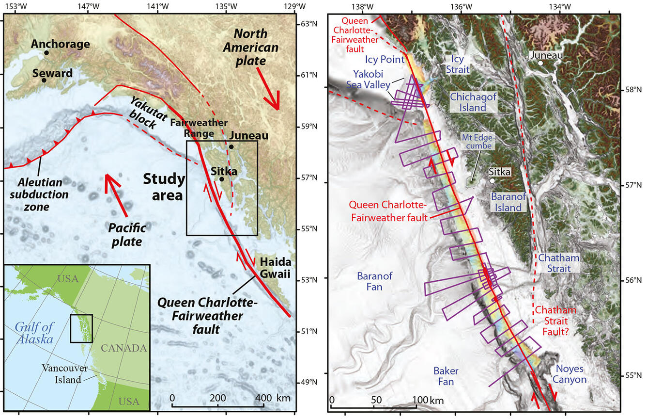
Left: Key features in and around the Gulf of Alaska. A black rectangle outlines our 2016 study area along the Queen Charlotte-Fairweather fault. Red arrows indicate relative tectonic plate motions. Right: A shaded relief map of the 2016 study area. Rainbow colors show seafloor depths acquired by the USGS in 2015 and 2016. Red indicates shallower depths. Purple zigzag lines show where we collected seismic-reflection data in 2016.
Sources/Usage
Public Domain.