
Kīlauea Volcano — Animation of Summit Enlargement

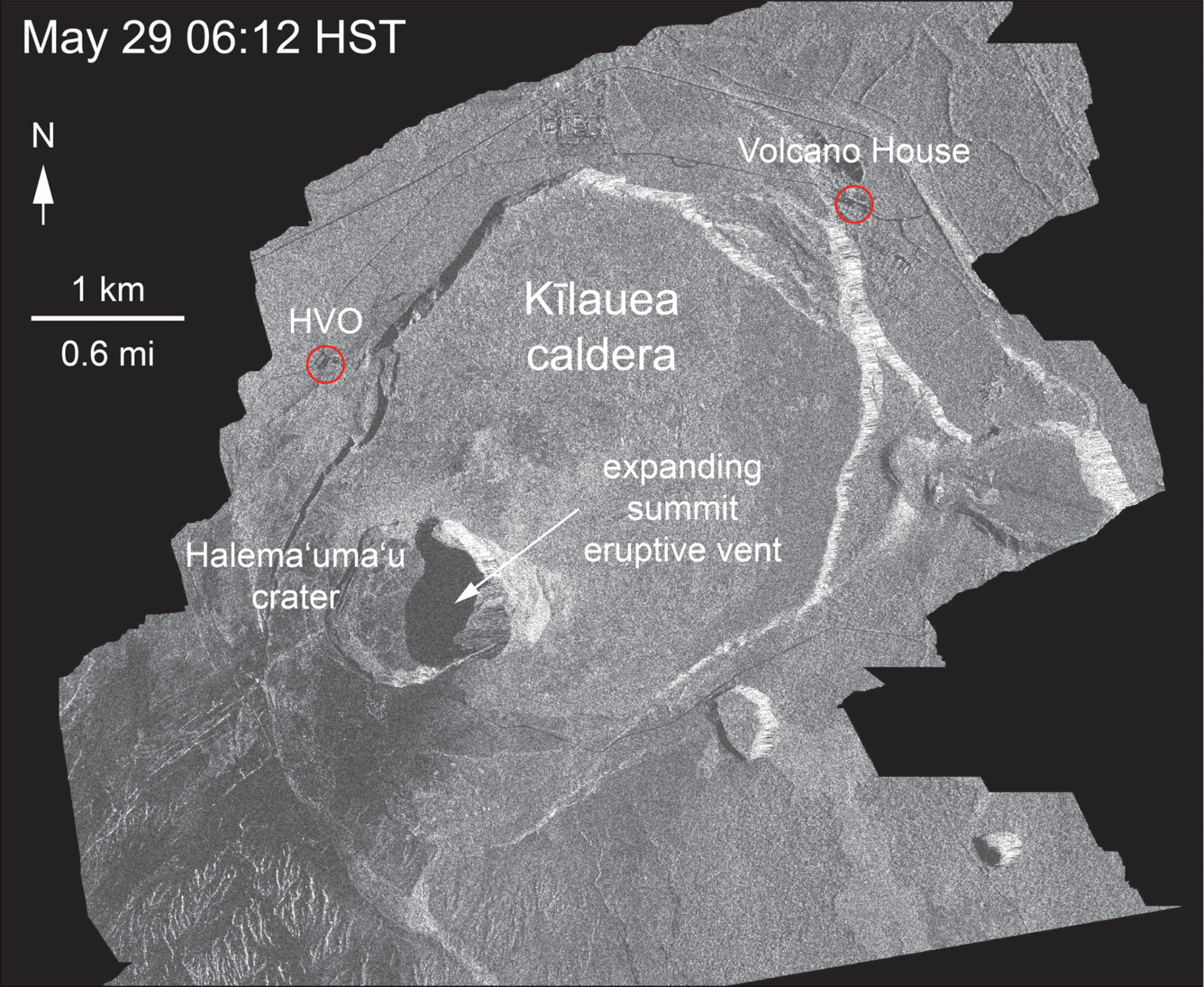
Detailed Description
This animated GIF shows a sequence of radar amplitude images that were acquired by the Italian Space Agency's Cosmo-SkyMed satellite system. The series shows changes to the caldera area of Kīlauea Volcano that occurred over May 5 at 6:12 a.m. HST, May 17 at 6:12 a.m. HST, May 21 at 6:12 a.m. HST, and May 29 at 6:12 a.m. HST. The satellite transmits a radar signal at the surface and measures the strength of the return, with bright areas indicating a strong return and dark areas a weak return. Strong returns indicate rough surfaces or slopes that point back at the radar, while weak returns come from smooth surfaces or slopes angled away from the radar. The May 5 image was acquired before any small explosions occurred from the summit. The May 17, 21, and 29 images show changes to the summit area after the onset of small explosions and ash emissions. Major changes over time include: (1) a darkening of the terrain south of Halema‘uma‘u, which reflects accumulation of ash; (2) enlargement of the summit eruptive vent on the floor of Halema‘uma‘u. The apparent slumping of the east rim of Halema‘uma‘u is not actual motion of the ground, but is an effect of the radar viewing angle, which is from the side instead of being straight down.
Sources/Usage
Public Domain.