
The Klamath River: Pre-Dam Removal, sediment limited
Detailed Description
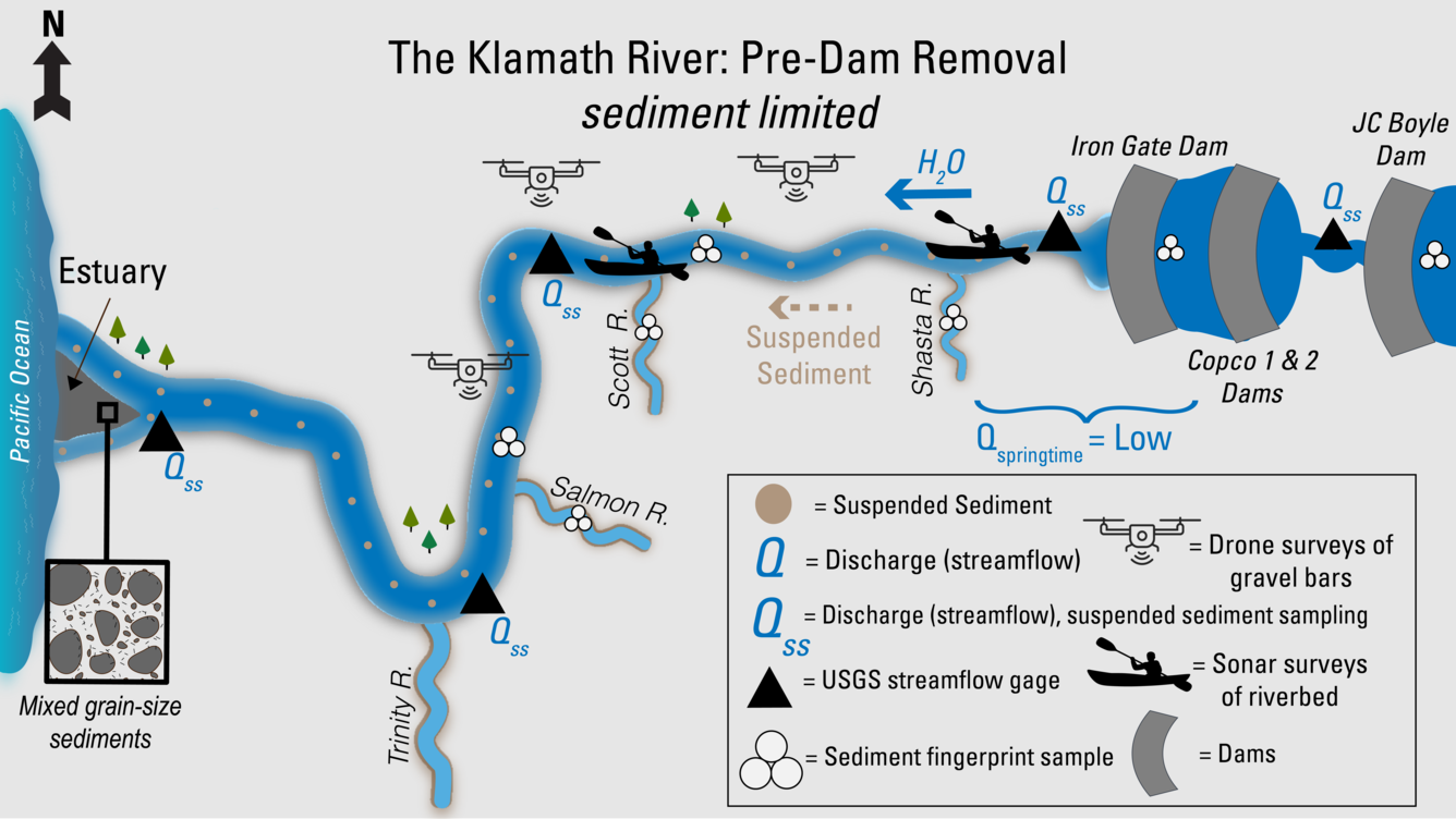
This illustration shows USGS work on the Klamath River and its main tributaries before the dams were removed. Iron Gate, Copco 1 and 2, and JC Boyle Dams blocked the river’s flow and trapped sediment. As a result, only small amounts of suspended sediment made it downstream, and springtime flows were low. USGS measured streamflow and sediment at gaging stations along the river and tributaries. Scientists also collected sediment fingerprint samples from reservoirs, the main river, and the Salmon, Scott, and Shasta Rivers to trace sediment sources. Drones scanned gravel bars, and sonar from boats mapped the riverbed. At the river’s mouth, the bed sediment in the Klamath estuary had a mix of sediment sizes.
Sources/Usage
Public Domain.