
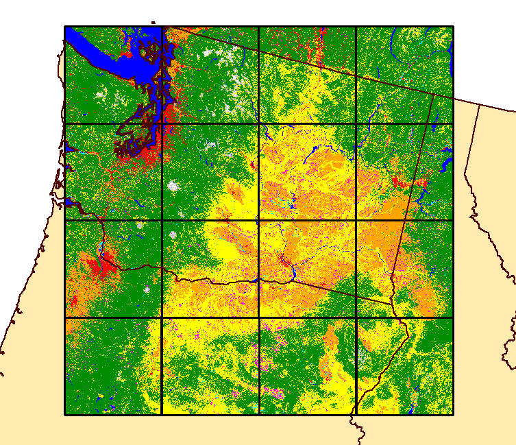
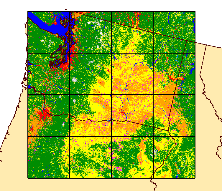
Land Change Monitoring, Assessment and Projection prototype tile
By Earth Resources Observation and Science (EROS) Center
2011 (approx.)
Detailed Description
Prototype 2011 land cover for a portion of the Pacific Northwest generated using automated Land Change Monitoring, Assessment and Projection land classification capabilities, developed at the U.S. Geological Survey's Earth Resources Observation and Science (EROS) Center.
Sources/Usage
Public Domain.