
Landsat 9 Image of Kangerdlugssuaq Glacier, Greenland

Detailed Description
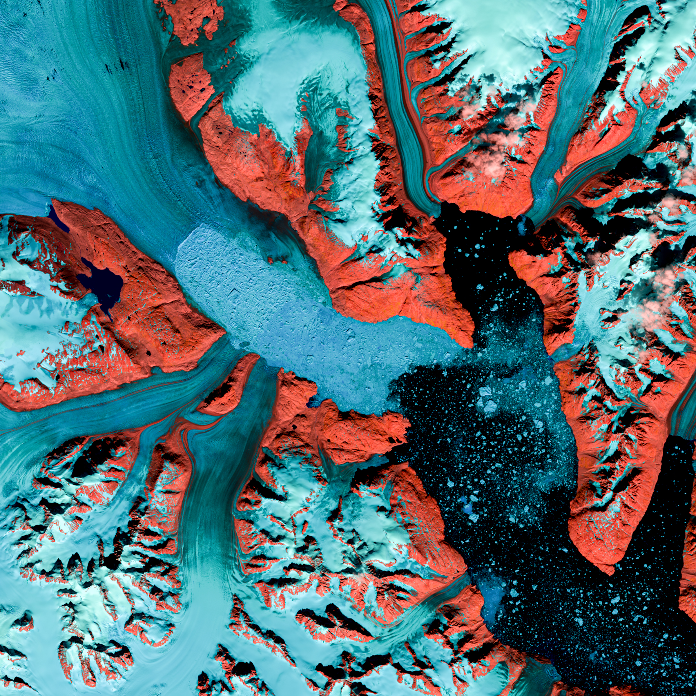
Named after a Greenlandic word meaning “large fjord,” Kangerdlugssuaq Glacier is one of the largest tidewater outlet glaciers in Greenland. It flows from the fjord of the same name, the second largest found on the east side of the island. This false color Landsat 9 image was acquired July 29, 2022, using Bands 5|4|3. Ice and snow appear as light blue while water is a dark blue and barren, rocky land is red.
Through remote sensing satellites like Landsat, scientists monitor Greenland ice, glaciers, and fjords. Loss of ice sheets is a major factor in projecting future sea level rise. Satellite-based techniques allow regular study of these inaccessible, inhospitable areas. Scientists can leverage half of a century of Landsat data to observe changes in the area over time. Landsat 9 carries this legacy into the future.
Learn more about Landsat 9 at https://www.usgs.gov/landsat-missions/landsat-9
Sources/Usage
Public Domain.