
Landsat 9 Imagery Improved by Calibration Update
Detailed Description
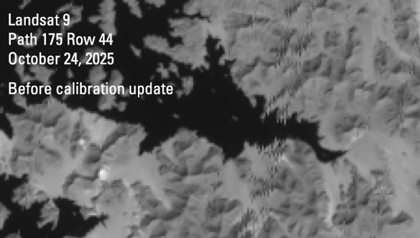
This animation displays how updated calibration coefficients improve and correct Landsat imagery.
When the Landsat 9 satellite returned to normal image acquisitions following a safehold event in October 2025, the imagery acquired by the Operational Land Imager displayed offsets, or shifts, as seen in the before image. Once updated calibration coefficients were generated and applied to the data, the offsets were removed and the imagery improved.
Landsat 9, Path 175 Row 44, Band 7
Acquired October 24, 2025
Sources/Usage
Public Domain.