
Landsat Mosaic of the Yukon River Basin
Detailed Description
Michelle A. Bouchard, John L. Dwyer and Brian Granneman.
American Geophysical Union, Fall Meeting 2009, abstract #GC51A-0708
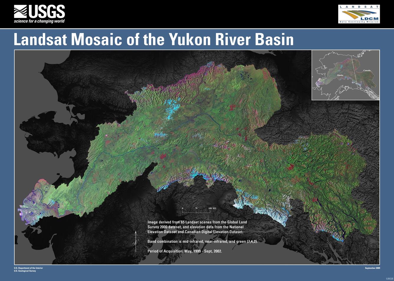
Landsat data from the Global Land Survey (GLS) dataset for year 2000 was mosaicked to form a Yukon River Basin image map that is referenced to a geodetic base. It was produced from 65 Landsat-7 Enhanced Thematic Mapper Plus (ETM+) images collected from 1999-2002. Two products were created: (1) a geographically referenced database containing all seven of the spectral bands for the individual scenes and (2) a 3-band (shortwave infrared, near-infrared, and green - 7,4,2) radiometrically normalized shaded relief image map using the U.S. Geological Survey National Elevation Dataset and Canadian Digital Elevation Data from Natural Resources Canada. The science data product will facilitate studies to map the extent of snow, ice and surface water at a basin-wide scale. Focused studies on snow/ice transitions for selected glaciers will be conducted in order to establish accumulation ratios for use in future monitoring. The mosaic also shows the complex patterns of wildfires in the interior forests and the diversity of ecosystems throughout the basin. The shaded relief product image mosaic is a reference map for reconnaissance studies as well as a geographic framework within which to spatially integrate project-wide data and information.
Sources/Usage
Public Domain.