
Landsat View of the Strait of Belle Isle, Canada
Detailed Description
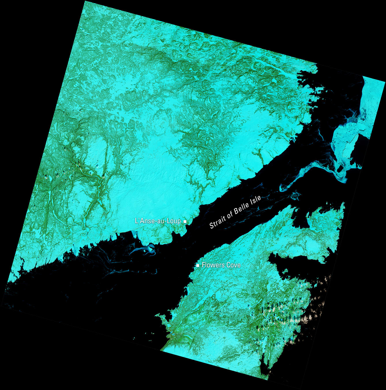
This Landsat 9 image of the Strait of Belle Isle, acquired April 8, 2025, uses the shortwave infrared, near infrared, and red spectral bands (bands 6,5,4) to highlight land cover. In this combination, healthy vegetation appears bright green, snow and ice appear in shades of cyan and blue, and water appears dark. The scene shows L’Anse-au-Loup on the Labrador coast and Flowers Cove on Newfoundland’s Great Northern Peninsula.
Scene ID: LC09_L2SP_005024_20250408_20250410_02_T1
Learn more about Landsat at the USGS Landsat Missions website.
Sources/Usage
Public Domain.