
Landsat Celebrates Major Open Data Milestone
On July 14, 2025, downloads of Landsat products passed 200,000 terabytes (TB)—roughly equivalent to the storage capacity of one million smartphones. This milestone highlights the vast scale of the Landsat archive and growing demand for its data.
This achievement stems from the 2008 policy change that made all Landsat products available for download from the U.S. Geological Survey for no-charge. In the last 17 years, scientists, land managers and the public have used this resource to understand the changes on our landscapes around the world.
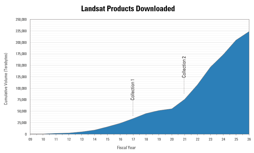
Today, the USGS archive contains more than 13.8 Petabytes (PB) of Landsat satellite data, packaged into a variety of products tailored to different needs. Landsat data are vital to scientists studying water and food security, agriculture, disaster response, land use and land cover change, and energy and mineral development.
The 200,000-terabyte milestone is not just a number. It represents millions of studies, projects, and decisions supported by the Landsat Program around the world — from safeguarding food and water resources to guiding disaster response.
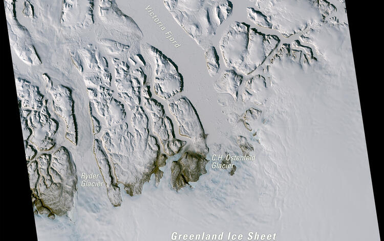
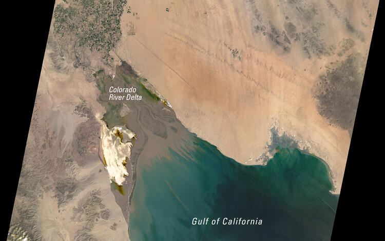
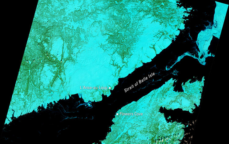
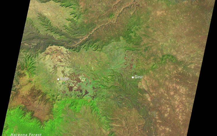
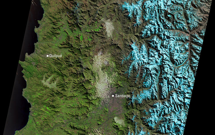
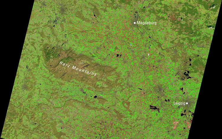
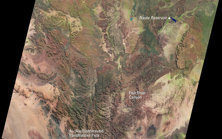
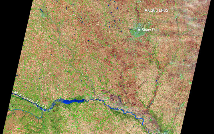
Below are a few of the 215 images that were downloaded within the first minute of the milestone being reached.
Visit these webpages for more information about accessing data and more interesting Landsat statistics.
-
Landsat Data Access Landsat Data Access
In 2008, the Landsat products stored in the USGS EROS archive became available for download at no cost to users. The applications described below allow access to the Landsat products from the USGS archive. Each application provides unique capabilities that may be useful to user preferences, as either single file or large quantity (bulk) downloads.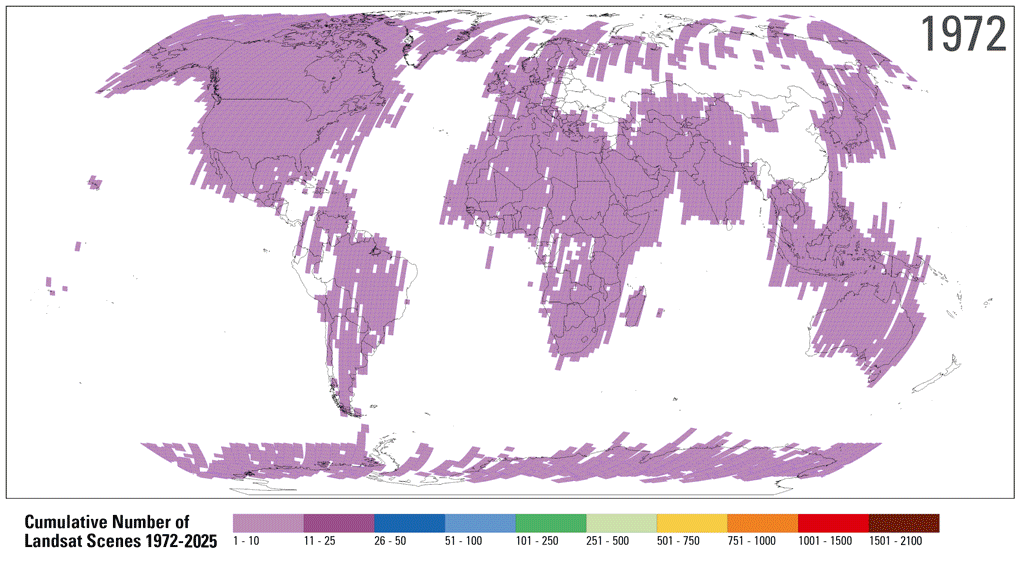
Landsat Project Statistics Landsat Project Statistics
How much Landsat data is available, and how much is downloaded? Who downloads Landsat products and what do they use it for? We answer these questions and more on this page.
Related

Landsat in Action - Free & Open Landsat Archive with Barbara Ryan
Barbara Ryan, Director of GEO talks about the distribution of Landsat data, starting in 1972, and ultimately transitioning to the free and open policy of today.

How do I search for and download Landsat data? How do I search for and download Landsat data?
Landsat data products held in the USGS archives can be searched and downloaded at no charge from a variety of sources. Visit Landsat Data Access for information about how Landsat data products can be downloaded individually or in bulk. Landsat imagery not found in the USGS archive might have been collected by one of the USGS International Cooperator ground stations, each of which are the primary...
Related
Landsat in Action - Free & Open Landsat Archive with Barbara Ryan
Barbara Ryan, Director of GEO talks about the distribution of Landsat data, starting in 1972, and ultimately transitioning to the free and open policy of today.
How do I search for and download Landsat data? How do I search for and download Landsat data?
Landsat data products held in the USGS archives can be searched and downloaded at no charge from a variety of sources. Visit Landsat Data Access for information about how Landsat data products can be downloaded individually or in bulk. Landsat imagery not found in the USGS archive might have been collected by one of the USGS International Cooperator ground stations, each of which are the primary...