
Landslides & Liquefaction.png
Detailed Description
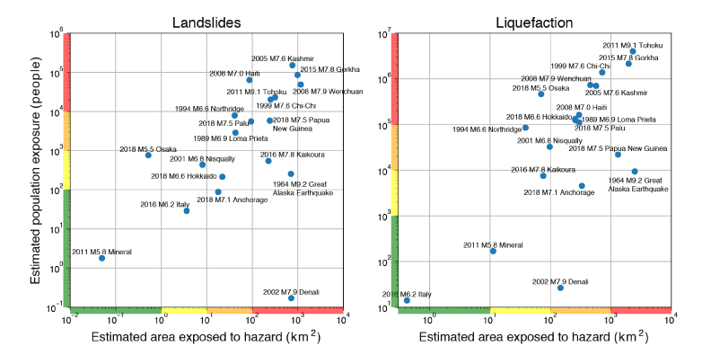
Alert statistics computed for a selection of historic events (for which ShakeMaps are available) comparing the estimated area exposed to hazard (Htot) to the estimated population exposure (popexp). The colored bars on the edges of each plot correspond to the four alert level bins.
Sources/Usage
Public Domain.
Alert statistics computed for a selection of historic events (for which ShakeMaps are available) comparing the estimated area exposed to hazard (Htot) to the estimated population exposure (popexp). The colored bars on the edges of each plot correspond to the four alert level bins.