
Large scale orthophoto map
Detailed Description
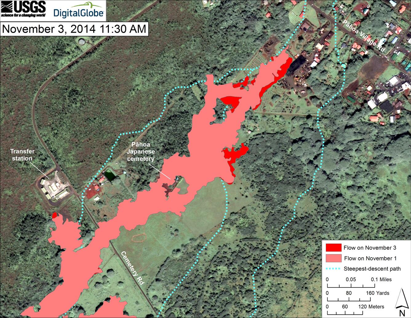
This map uses a satellite image acquired in March 2014 (provided by Digital Globe) as a base to show the area around the front of the June 27th lava flow. The area of the flow on November 1, 2014, at 11:00 AM is shown in pink, while widening and advancement of the flow as mapped on November 3 at 11:30 AM is shown in red. The latitude and longitude of the front of the narrow finger of lava advancing toward Pāhoa was 19.49590, -154.95256 (Decimal Degrees; WGS84). The dotted blue lines show steepest-descent paths in the area, calculated from a 1983 digital elevation model (DEM).
The flow has not advanced during the last 24 hours. At the time of mapping, the tip of the flow was stalled, but a few breakouts were active just upslope from the front.
Steepest-descent path analysis is based on the assumption that the DEM perfectly represents the earth's surface. DEMs, however, are not perfect, so the dotted blue lines can be used to infer only approximate flow paths. For calculation details, see http://pubs.usgs.gov/of/2007/1264/.