
las moras fig 3.jpg
By Western Geographic Science Center
March 2026 (approx.)
Detailed Description
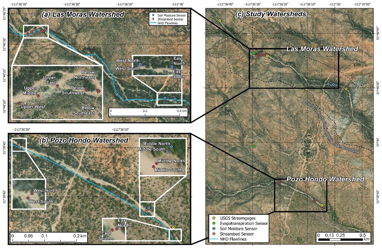
Figure 3. Map of paired watershed monitoring devices INSTALLED AT Santa Margarita Ranch.
Sources/Usage
Public Domain.
Related
Las Moras Wash Restoration: Integrated Geomorphic Assessment, Modeling, Monitoring, and Adaptive Management
The Las Moras Wash, within the Santa Margarita Ranch, Altar Valley, AZ, exhibits channel incision, gully expansion, head‑cut migration, vegetation loss, and reduced hydrologic connectivity between upper watershed and floodplains.