
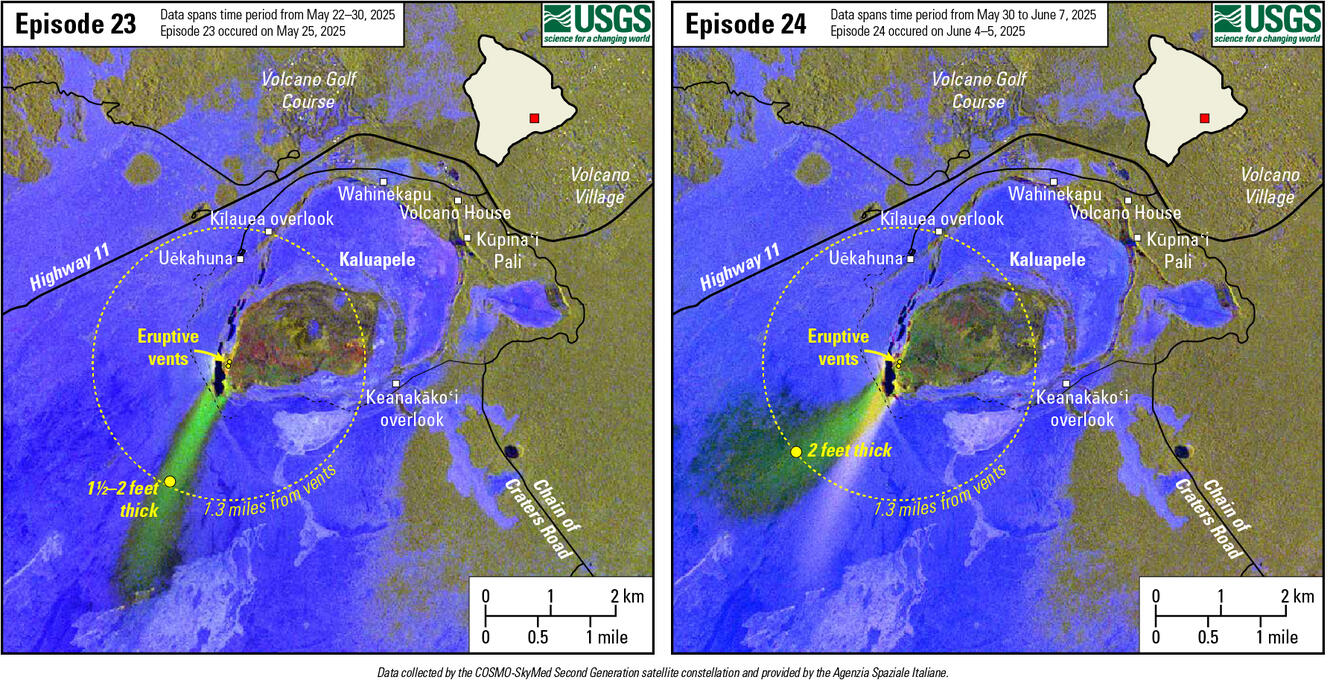
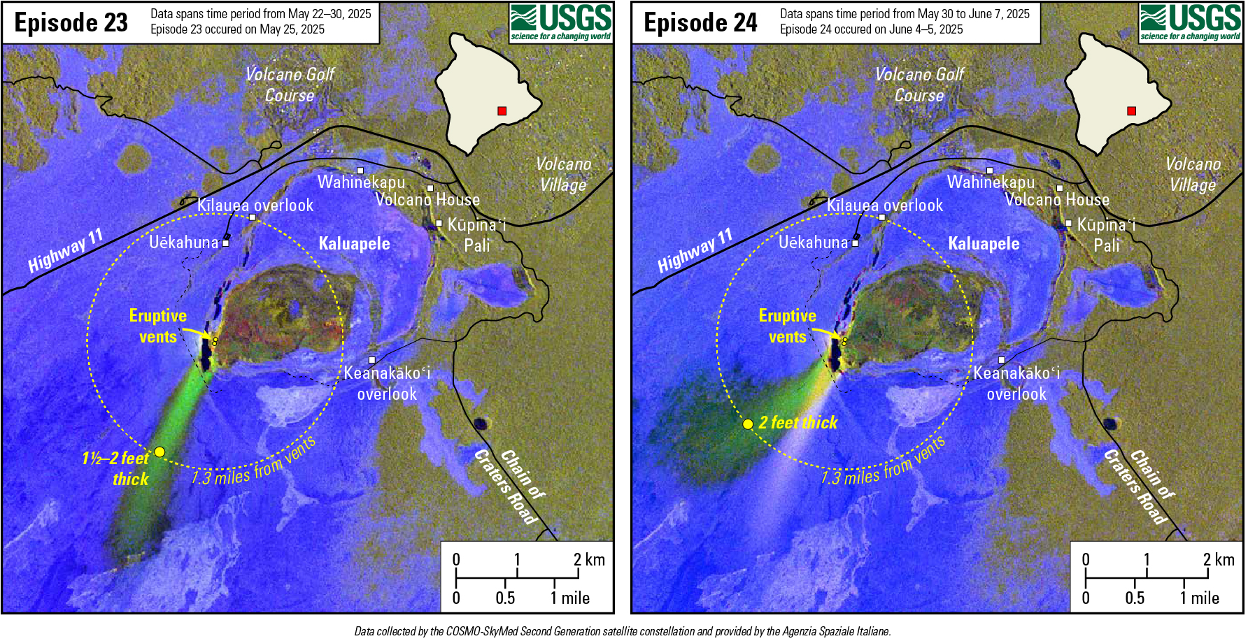
lava flow and tephra accumulation at Kīlauea volcano associated with episodes 23 (left) and 24 (right) of the ongoing eruption in Halemaʻumaʻu
Detailed Description
These maps show lava flow and tephra accumulation at Kīlauea volcano associated with episodes 23 (left) and 24 (right) of the ongoing eruption in Halemaʻumaʻu that started on December 23, 2024, using data recorded by the Italian Space Agency's (ASI) COSMO-SkyMed Second Generation satellite constellation. These maps combine cross-polarized radar amplitude images taken on two different dates, along with interferometric coherence from the time between those dates. In the maps, unchanged barren areas are represented in blue/purple, vegetated areas appear in yellow/light green, and new deposits over barren land are shown in either dark or bright green. Large yellow dots show measured tephra deposit thickness, and the dotted circle encompasses distances within 1.3 miles (2.1 kilometers) of the eruptive vents. Public viewing areas within Hawaiʻi Volcanoes National Park are indicated with white squares; these can be temporarily closed for public safety.
Sources/Usage
Public Domain.