



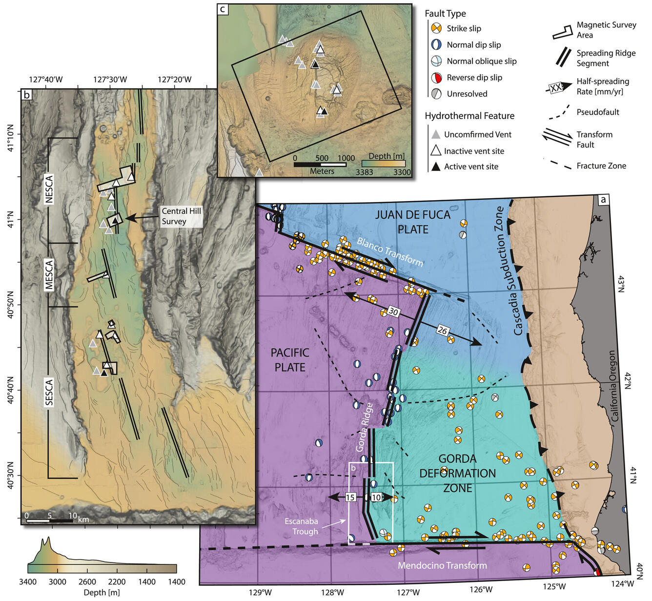
Map of Escanaba Trough, showing tectonic setting and survey lines


Detailed Description
Map of the Escanaba Trough. (a) A regional map of the tectonic setting surrounding the Gorda Ridge spreading center, with central moment tensor data indicating faulting dynamics; (b) a map of the Escanaba Trough, with this study's six magnetic surveys outlined, including mapped lineaments as black lines; and (c) an inset of Central Hill as an example of an uplifted sediment mound that hosts the majority of the spreading segment's current hydrothermal activity. From the study Tectonic controls on volcanism and associated hydrothermal activity in a sediment-dominated mid-ocean ridge; Escanaba Trough.
Sources/Usage
Public Domain.