
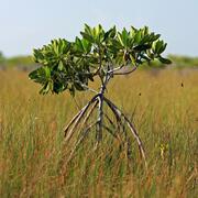
Map of Everglades National Park
By Wetland and Aquatic Research Center
2010 (approx.)

Detailed Description
Map of Everglades National Park. Note: Map generated prior to the renaming of the Gulf in Feb 2025.
Sources/Usage
Public Domain.
Related
Developing a Roadmap for the Future of Natural Resources in Everglades National Park
To sustain economic and ecologically viable ecosystems into the future, USGS is developing freshwater delivery targets for water flowing southward into Everglades National Park by integrating climate and sea level projections, hydrologic modeling, and ecological modeling to forecast ecosystem responses to future freshwater availability scenarios.

Development of a Quantitative Risk Assessment Tool to Predict Invasiveness of Non-native Freshwater Fishes in Everglades National Park
The introduction of non-native fishes is a problem across the United States, particularly in Florida. USGS scientists are developing a decision support tool to help natural resourece managers prioritize which species to focus prevention, detection, rapid response, and control efforts.
Related
Developing a Roadmap for the Future of Natural Resources in Everglades National Park
To sustain economic and ecologically viable ecosystems into the future, USGS is developing freshwater delivery targets for water flowing southward into Everglades National Park by integrating climate and sea level projections, hydrologic modeling, and ecological modeling to forecast ecosystem responses to future freshwater availability scenarios.
Development of a Quantitative Risk Assessment Tool to Predict Invasiveness of Non-native Freshwater Fishes in Everglades National Park
The introduction of non-native fishes is a problem across the United States, particularly in Florida. USGS scientists are developing a decision support tool to help natural resourece managers prioritize which species to focus prevention, detection, rapid response, and control efforts.