
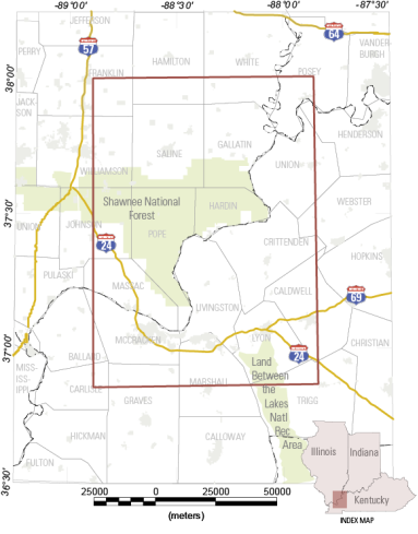
Map Indicating Flight Area for Tri-State Low-Level Flight Survey

Detailed Description
Map indicating flight area for tri-state low-level flight survey. The flights will cover 23 counties in Illinois, Kentucky and Indiana, and are included within the red rectangle. Flights began in October and are expected to conclude in December, 2019.
Sources/Usage
Public Domain.
Related

Geophysical Mapping of Geologic Systems Host to Critical Mineral Deposits, Southern Midcontinent, US
The objective of this project is to use high-resolution state-of-the-art airborne and regional ground geophysical methods to map an underexplored region of the southern Midcontinent that is important to economic and critical mineral deposits.
Related
Geophysical Mapping of Geologic Systems Host to Critical Mineral Deposits, Southern Midcontinent, US
The objective of this project is to use high-resolution state-of-the-art airborne and regional ground geophysical methods to map an underexplored region of the southern Midcontinent that is important to economic and critical mineral deposits.