
Geophysical Mapping of Geologic Systems Host to Critical Mineral Deposits, Southern Midcontinent, US
The objective of this project is to use high-resolution state-of-the-art airborne and regional ground geophysical methods to map an underexplored region of the southern Midcontinent that is important to economic and critical mineral deposits.
Science Issue and Relevance
The southern Midcontinent is a frontier region for mineral exploration. The region is largely underexplored because most of the geology that is important to economic mineral deposits is concealed. Sedimentary cover over and structural relief on buried igneous basement can be substantial. Consequently, conventional surface mapping methods are poorly suited to map covered geologic systems. Subsurface mapping using geophysical techniques is required to characterize the geology and place it in a broader tectonic and mineral systems context.
Methods to Address Issue
The overall objective of this project is to collect, model and interpret high-resolution airborne and ground geophysical data to better understand the concealed geologic systems host to critical metal mineralization. Interpretation of the geophysical data will be supported by drill core examination of concealed geology where available. We are coordinating ground and airborne geophysical efforts across USGS Program and Mission areas including projects funded by the Mineral Resources Program, National Cooperative Geologic Mapping Program, and Water Mission Area. We plan to meet these objectives via three tasks.
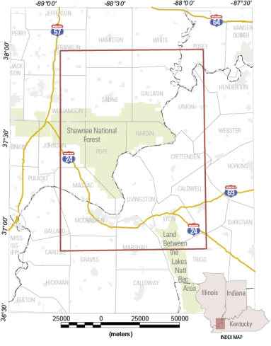
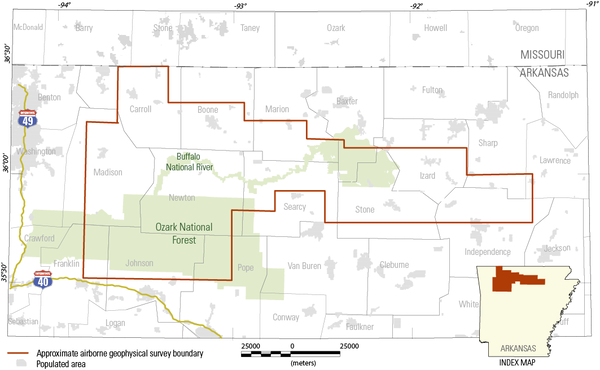
- Airborne Magnetic and Radiometric Framework: task objectives are to oversee the collection, processing, and interpretation of several airborne geophysical surveys occurring in the southern Midcontinent
- Electrical Resistivity Framework- Airborne Electromagnetics (EM) and Ground Magnetotellurics (MT): task objective is to use recently collected MT data over the southern Midcontinent to create 3D inversions of the crust underlying important critical mineral deposits in the southern Midcontinent
- Proterozoic geologic framework of southeast Missouri: task objective is to finalize a new 1:250,000-scale geologic map of the St. Francois Mountains and provide geologic framework information critical for support of the geophysical surveys and resulting models and interpretations core to this new project
Data collected as part of our project will be made public and used by the USGS and other federal, state, and industry partners to guide more detailed geologic mapping at local scales. When the data analysis is complete, results will provide state-of-the-art, subsurface maps that will contribute to a wide range of 3D representations of the nations exposed and concealed geology.
Below are other science projects associated with this project.

Systems Approach to Critical Minerals Inventory, Research, and Assessment

Ozark Dome-Arkoma Basin-Ouachita Transect
Unconventional Stratabound Critical Mineral Deposits of the Midcontinent: Linkages Between Mineralization in Marine Epicontinental Sedimentary Basin Systems

Mississippi Alluvial Plain (MAP): Water Use and Availability Program
The objective of this project is to use high-resolution state-of-the-art airborne and regional ground geophysical methods to map an underexplored region of the southern Midcontinent that is important to economic and critical mineral deposits.
Science Issue and Relevance
The southern Midcontinent is a frontier region for mineral exploration. The region is largely underexplored because most of the geology that is important to economic mineral deposits is concealed. Sedimentary cover over and structural relief on buried igneous basement can be substantial. Consequently, conventional surface mapping methods are poorly suited to map covered geologic systems. Subsurface mapping using geophysical techniques is required to characterize the geology and place it in a broader tectonic and mineral systems context.
Methods to Address Issue
The overall objective of this project is to collect, model and interpret high-resolution airborne and ground geophysical data to better understand the concealed geologic systems host to critical metal mineralization. Interpretation of the geophysical data will be supported by drill core examination of concealed geology where available. We are coordinating ground and airborne geophysical efforts across USGS Program and Mission areas including projects funded by the Mineral Resources Program, National Cooperative Geologic Mapping Program, and Water Mission Area. We plan to meet these objectives via three tasks.
- Airborne Magnetic and Radiometric Framework: task objectives are to oversee the collection, processing, and interpretation of several airborne geophysical surveys occurring in the southern Midcontinent
- Electrical Resistivity Framework- Airborne Electromagnetics (EM) and Ground Magnetotellurics (MT): task objective is to use recently collected MT data over the southern Midcontinent to create 3D inversions of the crust underlying important critical mineral deposits in the southern Midcontinent
- Proterozoic geologic framework of southeast Missouri: task objective is to finalize a new 1:250,000-scale geologic map of the St. Francois Mountains and provide geologic framework information critical for support of the geophysical surveys and resulting models and interpretations core to this new project
Data collected as part of our project will be made public and used by the USGS and other federal, state, and industry partners to guide more detailed geologic mapping at local scales. When the data analysis is complete, results will provide state-of-the-art, subsurface maps that will contribute to a wide range of 3D representations of the nations exposed and concealed geology.
Below are other science projects associated with this project.
Systems Approach to Critical Minerals Inventory, Research, and Assessment
Ozark Dome-Arkoma Basin-Ouachita Transect
Unconventional Stratabound Critical Mineral Deposits of the Midcontinent: Linkages Between Mineralization in Marine Epicontinental Sedimentary Basin Systems