
Map of June 27th flow in Kīlauea's ERZ

Detailed Description
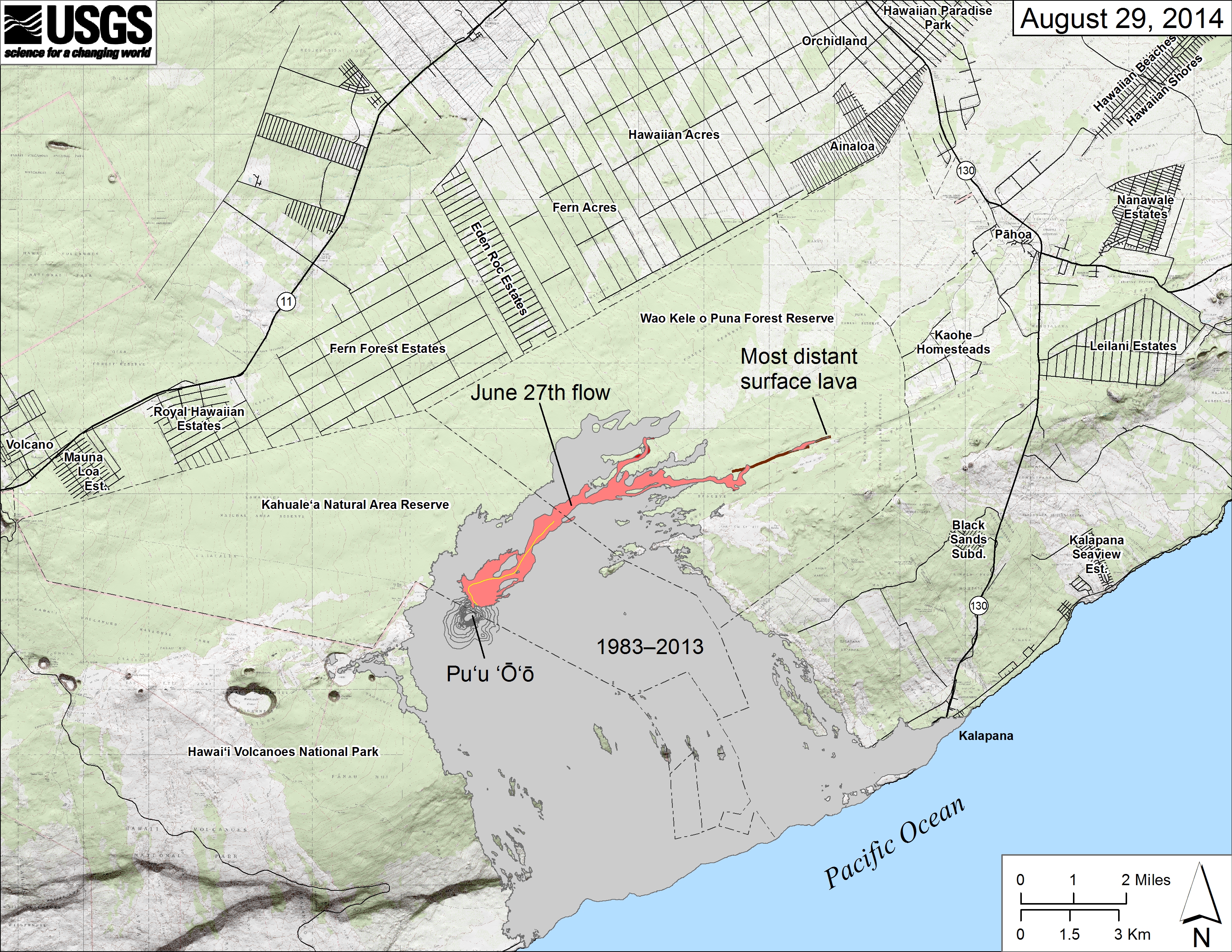
Map showing the June 27th flow in Kīlauea's East Rift Zone as of August 29, 2014. The area of the flow as mapped on August 28 is shown in pink, while widening and advancement of the flow as of August 29 is shown in red. All older lava flows (1983-2014) are shown in gray. The thin yellow line marks a portion of the lava tube feeding the flow.
The brown line at the far end of the flow marks the ground crack that has channeled lava to the east. Over the past day, lava has emerged from this ground crack with a small amount spilling onto the surface. The farthest reach of this lava, marked on the map, was 11.9 km (7.4 miles) from the vent and 2.6 km (1.6 miles) from east boundary of the Wao Kele o Puna Forest Reserve.
Sources/Usage
Public Domain.