
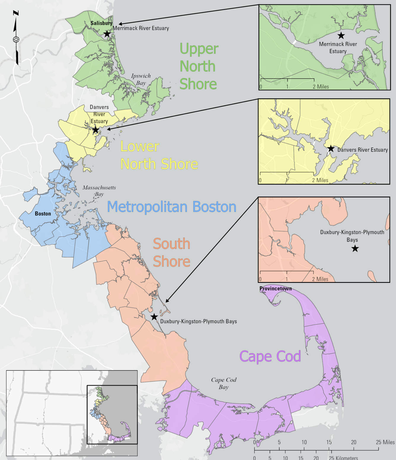
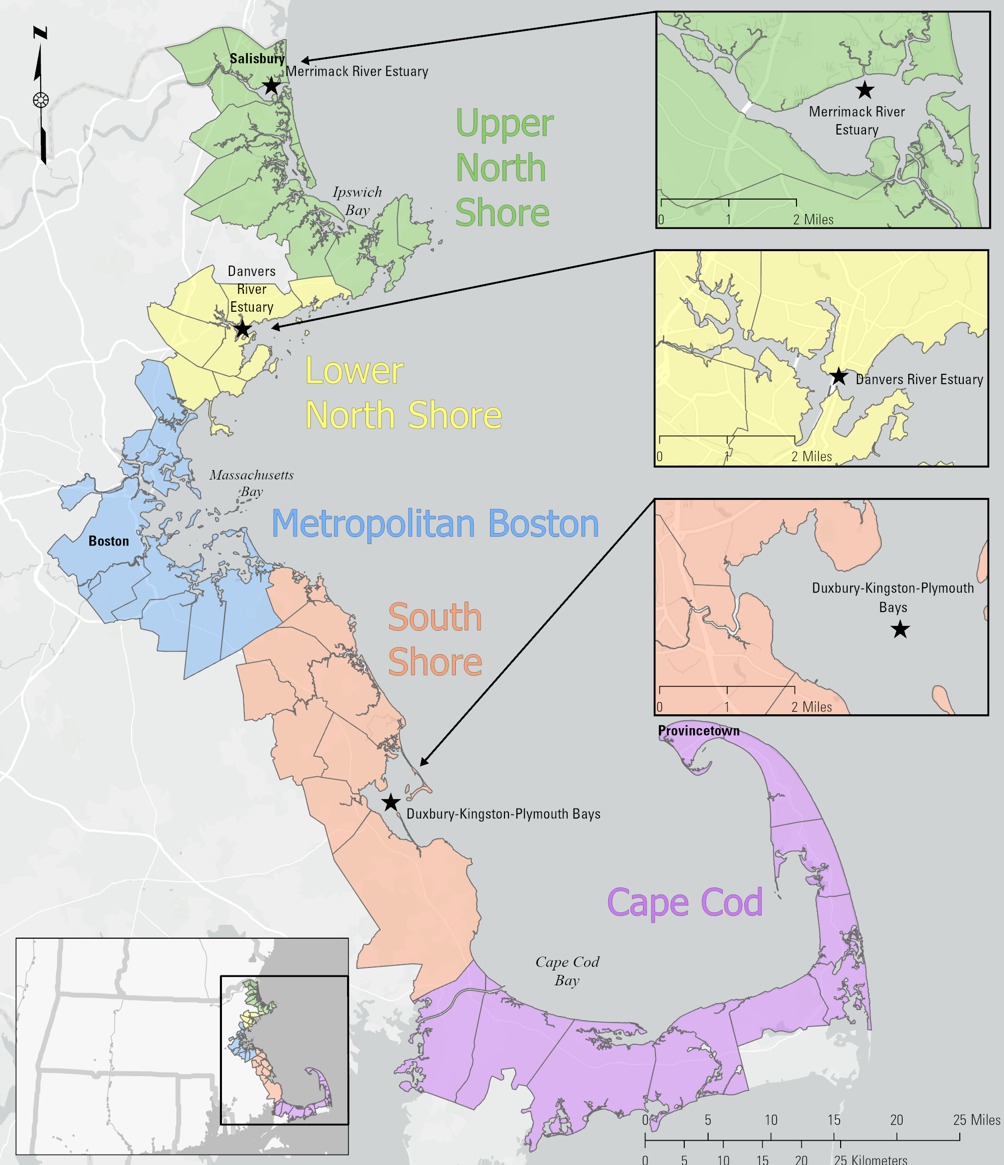
Map of MassBays Water Quality Monitoring Locations
By New England Water Science Center
May 2025 (approx.)
Detailed Description
This map shows the location of the water quality monitoring sites chosen for a monitoring project meant to support the goals of the Massachusetts Bays National Estuary Partnership (MassBays) and the EPA National Estuary Program.
Sources/Usage
Public Domain.
Related
Coastal Water-Quality Monitoring in Massachusetts
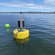
The U.S. Geological Survey (USGS) operates high‑resolution, continuous water‑quality monitoring stations in estuaries across coastal Massachusetts to better understand these dynamic ecosystems. These efforts include collaborations with the Massachusetts Bays National Estuary Partnership (MassBays) and the Massachusetts Department of Environmental Protection (MassDEP) to support Clean Water Act...
Related
Coastal Water-Quality Monitoring in Massachusetts
The U.S. Geological Survey (USGS) operates high‑resolution, continuous water‑quality monitoring stations in estuaries across coastal Massachusetts to better understand these dynamic ecosystems. These efforts include collaborations with the Massachusetts Bays National Estuary Partnership (MassBays) and the Massachusetts Department of Environmental Protection (MassDEP) to support Clean Water Act...