
Coastal Water-Quality Monitoring in Massachusetts
The U.S. Geological Survey (USGS) operates high‑resolution, continuous water‑quality monitoring stations in estuaries across coastal Massachusetts to better understand these dynamic ecosystems. These efforts include collaborations with the Massachusetts Bays National Estuary Partnership (MassBays) and the Massachusetts Department of Environmental Protection (MassDEP) to support Clean Water Act objectives, inform estuarine restoration goals, and provide baseline data for long-term ecosystem health tracking.
Estuaries are vital ecosystems that provide numerous ecological and economic benefits. They protect shorelines from erosion, serve as critical nursery grounds for shellfish and finfish, and support species vital to both commercial fisheries and recreational catch. Estuaries are highly vulnerable to stressors such as nutrient enrichment from land-based sources, warming waters, and acidification. Excess nutrients can lead to algal blooms, reduced water clarity, and dangerously low dissolved oxygen (DO) levels, which threaten aquatic life.
Continuous coastal water-quality monitoring is essential for understanding the dynamic conditions of estuarine environments. These ecosystems experience rapid changes driven by tides, daily cycles, and seasonal shifts, making high-frequency data critical for capturing variability that traditional sampling often misses. Monitoring provides baseline water-quality conditions in embayments that have historically been under-monitored and helps identify trends related to nutrient enrichment, warming waters, and acidification.
Objectives
USGS, in cooperation with MassDEP and MassBays, is working to characterize tidal, seasonal, and daily changes in water quality within selected Massachusetts estuaries that previously lacked continuous monitoring data. These data, which are made publicly available through USGS Water Data for the Nation, will inform the development of new water-quality thresholds that support eelgrass, fish, and other estuarine species.
MassBays Monitoring Project
This project supports the goals of the MassBays and the EPA National Estuary Program by:
- Supporting MassBays’ Comprehensive Conservation and Management Plan (CCMP) goals for habitat restoration and protection
- Contributing to the MassBays Ecohealth Tracking Tool and State of the Bays reporting
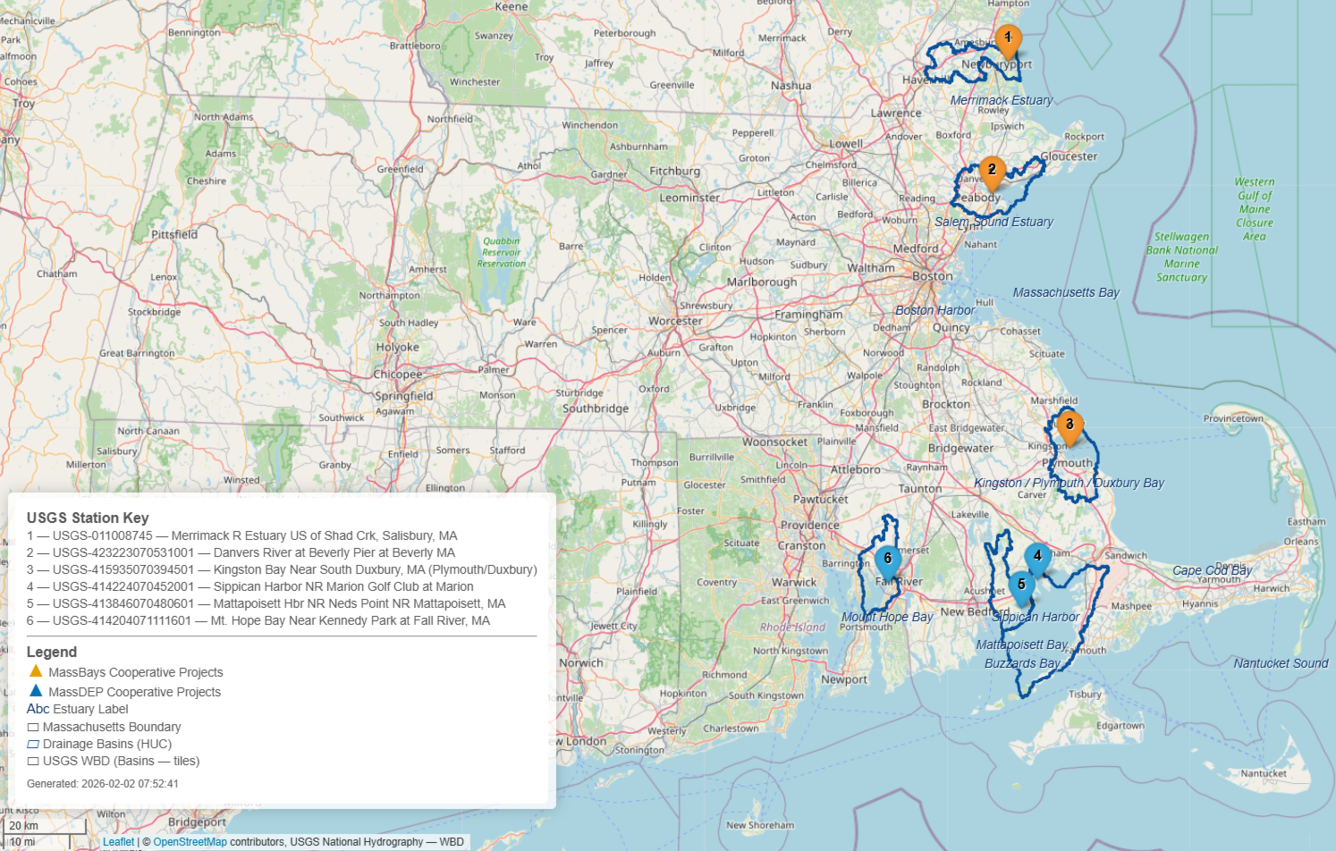
Continuous water-quality monitoring is being collected for: water temperature, specific conductance and salinity, dissolved oxygen, dissolved carbon dioxide, and pH. Monitoring is taking place at:
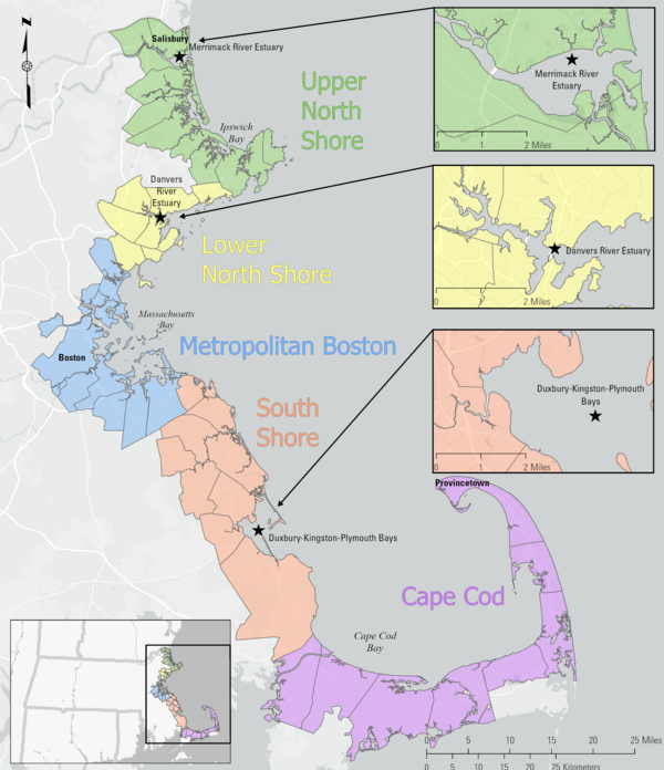
- Merrimack River Estuary (Upper North Shore)
- Danvers River Estuary (Lower North Shore)
- Duxbury-Kingston-Plymouth Bays (South Shore)
This map shows the location of the water quality monitoring sites chosen for a monitoring project meant to support the goals of the Massachusetts Bays National Estuary Partnership (MassBays) and the EPA National Estuary Program.
Buzzards Bay & Mount Hope Bay Monitoring Project
This project supports Massachusetts Department of Environmental Protection efforts to develop and refine nutrient and dissolved oxygen criteria for coastal waters by:
- Supporting the review and potential revision of Massachusetts Surface Water Quality Standards for dissolved oxygen and nitrogen
- Monitoring per- and polyfluoroalkyl substances (PFAS) using passive samplers to assess emerging contaminants in estuarine environments
- Characterizing spatial and vertical variability in water quality through profile and spatial surveys
- Providing high-quality data to support Clean Water Act objectives and inform management decisions
Continuous water-quality monitoring is being collected for the following parameters: water temperature, specific conductance and salinity, dissolved oxygen, pH, chlorophyll-a and phycoerythrin (used to help assess the presence or absence of algae), and nitrate (a form of nitrogen readily available to algae, which in excess can contribute to algal blooms). Monitoring is taking place at the following locations:
- Sippican Harbor
- Mattapoisett Harbor
- Mount Hope Bay
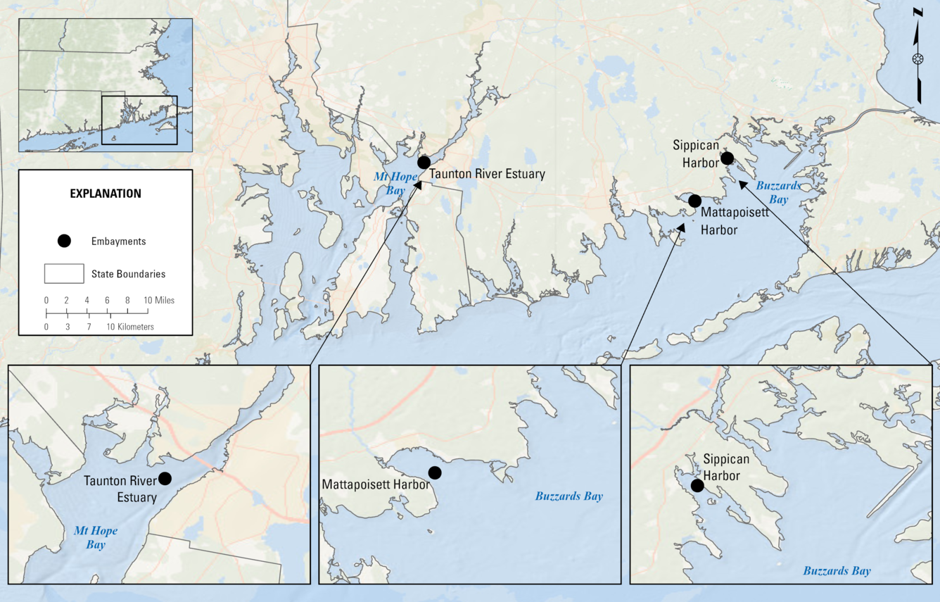
This map shows the location of the water quality monitoring sites chosen for a monitoring project meant to support the goals of the Massachusetts Department of Environmental Protection.
Approach
USGS uses a combination of:
- Collection of water-quality samples to assess nutrient levels in the bays.
- Vertical profile surveys to evaluate water column stratification—particularly to detect uneven mixing that may influence dissolved oxygen levels.
- Spatial surveys to determine how well mixed the estuary is across different locations.
- Passive sampling to establish baseline concentrations of PFAS in the bays.
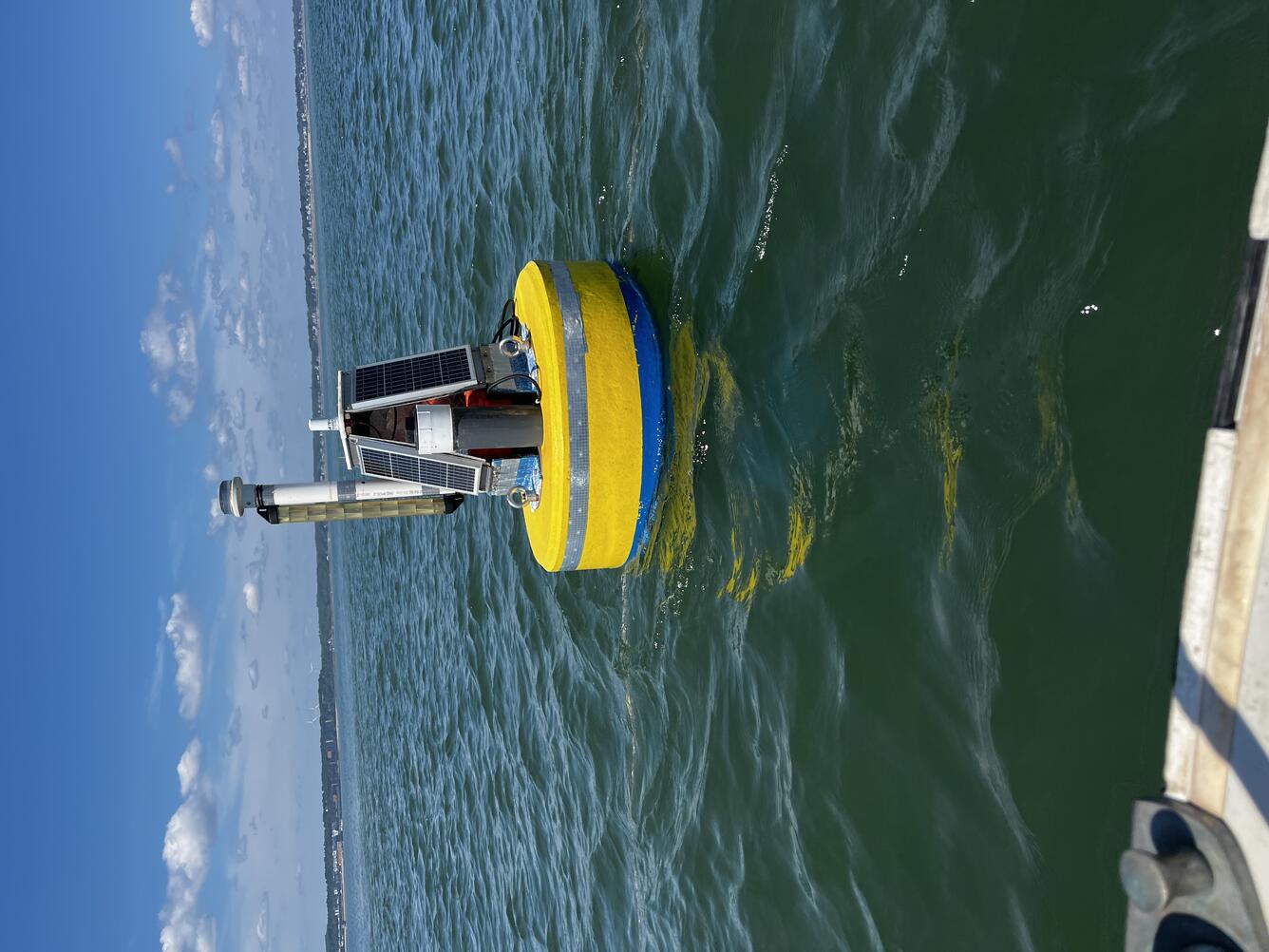
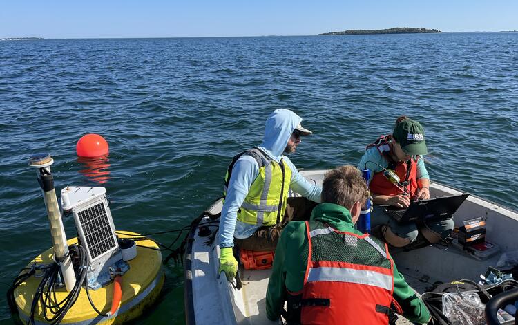
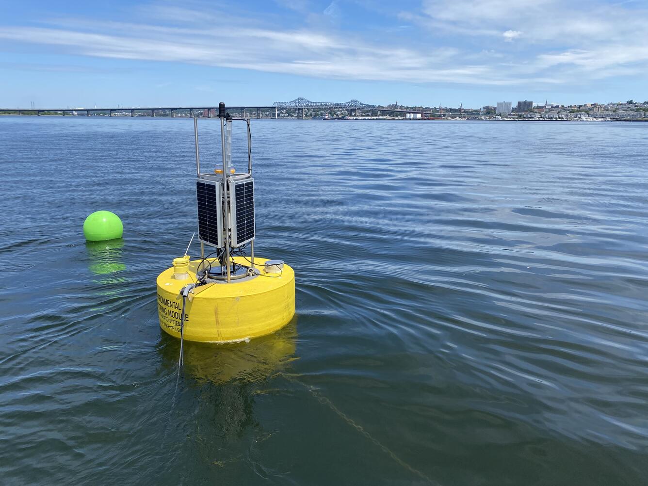
A buoy carrying water quality monitoring equipment deployed in Kingston Bay in South Duxbury, Massachusetts.
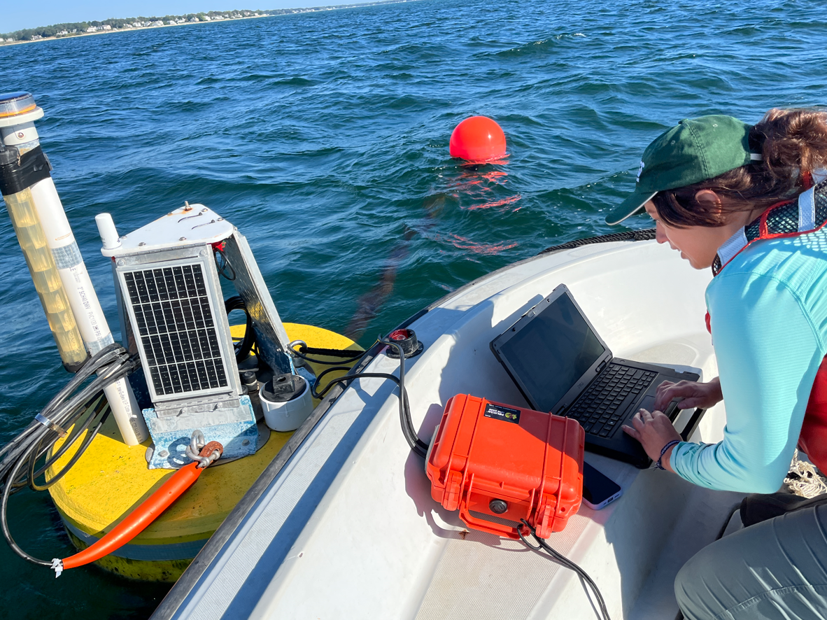
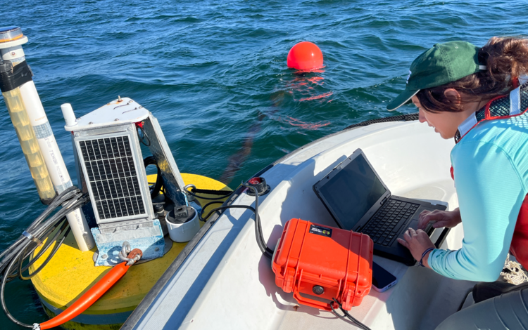
Hydrologic technician Kate Laabs downloads water quality data from the Kingston Bay buoy near South Duxbury, Massachusetts.
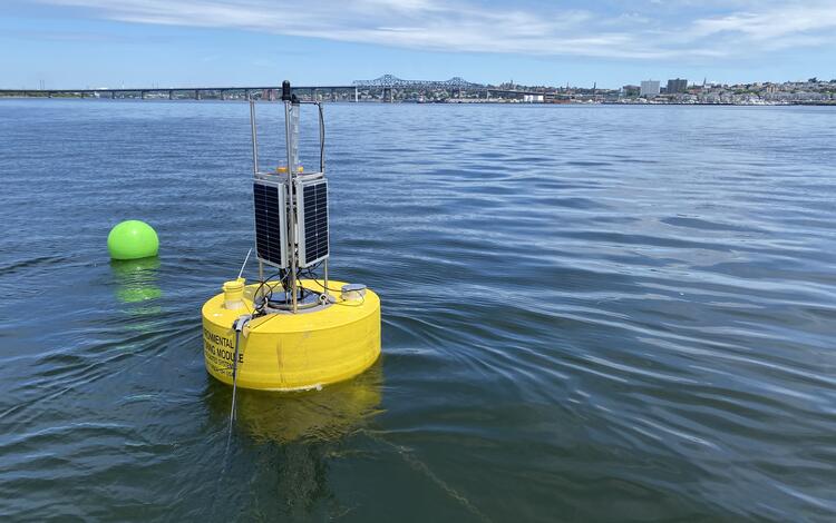
A buoy carrying water quality monitoring equipment deployed in Mount Hope Bay, Massachusetts.
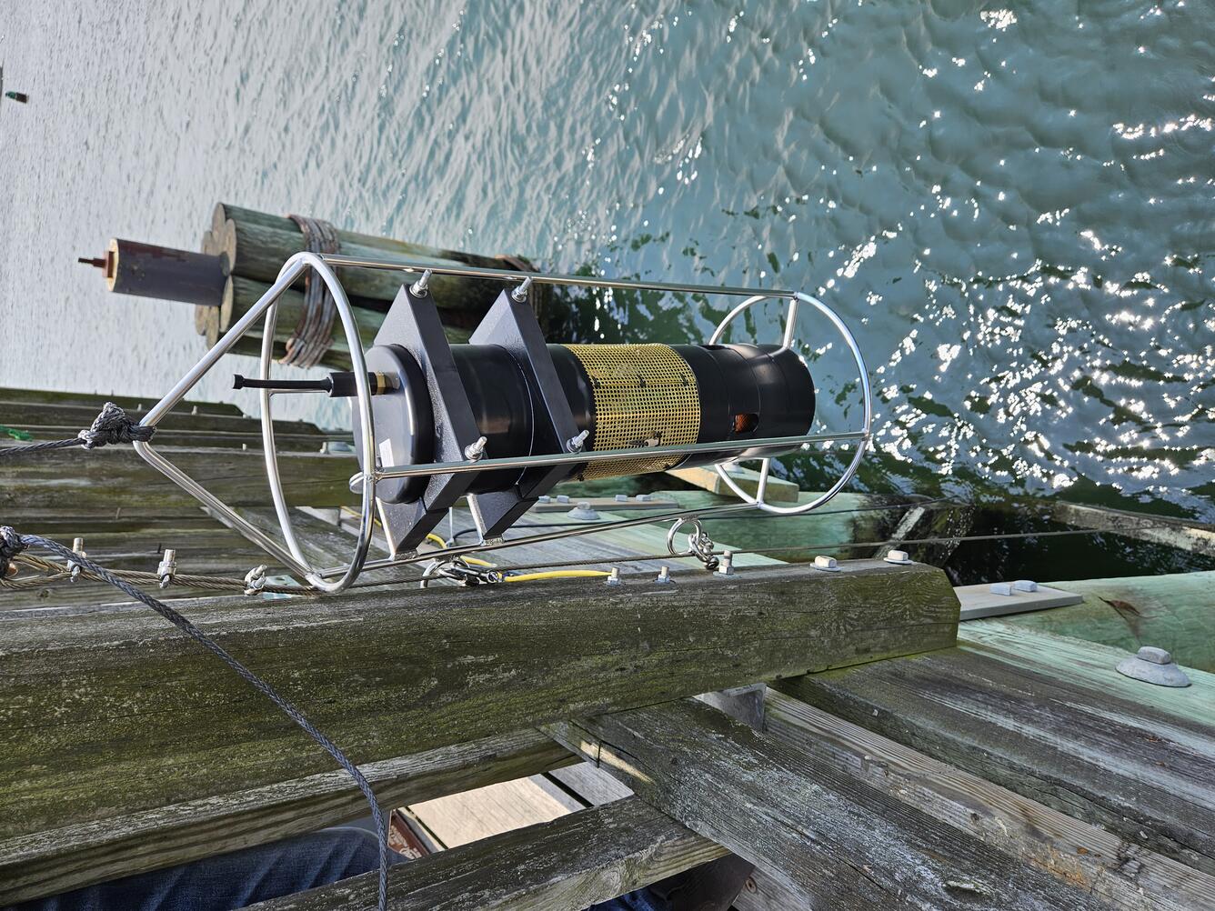
USGS staff deploy a carbon dioxide sensor (pCO2) from the Beverly Pier into the Danvers River in Beverly, Massachusetts.
The U.S. Geological Survey (USGS) operates high‑resolution, continuous water‑quality monitoring stations in estuaries across coastal Massachusetts to better understand these dynamic ecosystems. These efforts include collaborations with the Massachusetts Bays National Estuary Partnership (MassBays) and the Massachusetts Department of Environmental Protection (MassDEP) to support Clean Water Act objectives, inform estuarine restoration goals, and provide baseline data for long-term ecosystem health tracking.
Estuaries are vital ecosystems that provide numerous ecological and economic benefits. They protect shorelines from erosion, serve as critical nursery grounds for shellfish and finfish, and support species vital to both commercial fisheries and recreational catch. Estuaries are highly vulnerable to stressors such as nutrient enrichment from land-based sources, warming waters, and acidification. Excess nutrients can lead to algal blooms, reduced water clarity, and dangerously low dissolved oxygen (DO) levels, which threaten aquatic life.
Continuous coastal water-quality monitoring is essential for understanding the dynamic conditions of estuarine environments. These ecosystems experience rapid changes driven by tides, daily cycles, and seasonal shifts, making high-frequency data critical for capturing variability that traditional sampling often misses. Monitoring provides baseline water-quality conditions in embayments that have historically been under-monitored and helps identify trends related to nutrient enrichment, warming waters, and acidification.
Objectives
USGS, in cooperation with MassDEP and MassBays, is working to characterize tidal, seasonal, and daily changes in water quality within selected Massachusetts estuaries that previously lacked continuous monitoring data. These data, which are made publicly available through USGS Water Data for the Nation, will inform the development of new water-quality thresholds that support eelgrass, fish, and other estuarine species.
MassBays Monitoring Project
This project supports the goals of the MassBays and the EPA National Estuary Program by:
- Supporting MassBays’ Comprehensive Conservation and Management Plan (CCMP) goals for habitat restoration and protection
- Contributing to the MassBays Ecohealth Tracking Tool and State of the Bays reporting
Continuous water-quality monitoring is being collected for: water temperature, specific conductance and salinity, dissolved oxygen, dissolved carbon dioxide, and pH. Monitoring is taking place at:
- Merrimack River Estuary (Upper North Shore)
- Danvers River Estuary (Lower North Shore)
- Duxbury-Kingston-Plymouth Bays (South Shore)
This map shows the location of the water quality monitoring sites chosen for a monitoring project meant to support the goals of the Massachusetts Bays National Estuary Partnership (MassBays) and the EPA National Estuary Program.
Buzzards Bay & Mount Hope Bay Monitoring Project
This project supports Massachusetts Department of Environmental Protection efforts to develop and refine nutrient and dissolved oxygen criteria for coastal waters by:
- Supporting the review and potential revision of Massachusetts Surface Water Quality Standards for dissolved oxygen and nitrogen
- Monitoring per- and polyfluoroalkyl substances (PFAS) using passive samplers to assess emerging contaminants in estuarine environments
- Characterizing spatial and vertical variability in water quality through profile and spatial surveys
- Providing high-quality data to support Clean Water Act objectives and inform management decisions
Continuous water-quality monitoring is being collected for the following parameters: water temperature, specific conductance and salinity, dissolved oxygen, pH, chlorophyll-a and phycoerythrin (used to help assess the presence or absence of algae), and nitrate (a form of nitrogen readily available to algae, which in excess can contribute to algal blooms). Monitoring is taking place at the following locations:
- Sippican Harbor
- Mattapoisett Harbor
- Mount Hope Bay
This map shows the location of the water quality monitoring sites chosen for a monitoring project meant to support the goals of the Massachusetts Department of Environmental Protection.
Approach
USGS uses a combination of:
- Collection of water-quality samples to assess nutrient levels in the bays.
- Vertical profile surveys to evaluate water column stratification—particularly to detect uneven mixing that may influence dissolved oxygen levels.
- Spatial surveys to determine how well mixed the estuary is across different locations.
- Passive sampling to establish baseline concentrations of PFAS in the bays.
A buoy carrying water quality monitoring equipment deployed in Kingston Bay in South Duxbury, Massachusetts.
Hydrologic technician Kate Laabs downloads water quality data from the Kingston Bay buoy near South Duxbury, Massachusetts.
A buoy carrying water quality monitoring equipment deployed in Mount Hope Bay, Massachusetts.
USGS staff deploy a carbon dioxide sensor (pCO2) from the Beverly Pier into the Danvers River in Beverly, Massachusetts.