
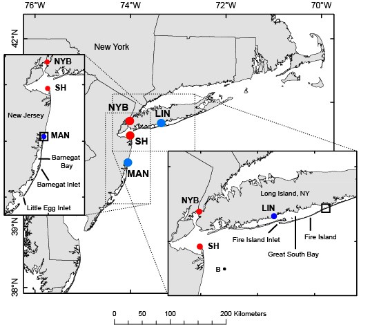
Map of Middle Atlantic Bight showing locations of water level stations
By Woods Hole Coastal and Marine Science Center
2013 (approx.)

Detailed Description
Map of Middle Atlantic Bight showing locations of water level stations at Mantoloking, New Jersey (MAN) and Lindenhurst, New York (LIN) in blue (in estuaries behind barrier islands); and at Sandy Hook, New Jersey (SH) in red (used as proxy for offshore water level). The Battery in New York (NYB) is also shown in red, but is not included in the analysis shown here. Inset maps show Barnegat Bay (left) and Great South Bay (right) and open squares show the location of breaches at Mantoloking, New Jersey and Old Inlet, New York that occurred during Hurricane Sandy.
Sources/Usage
Public Domain.