



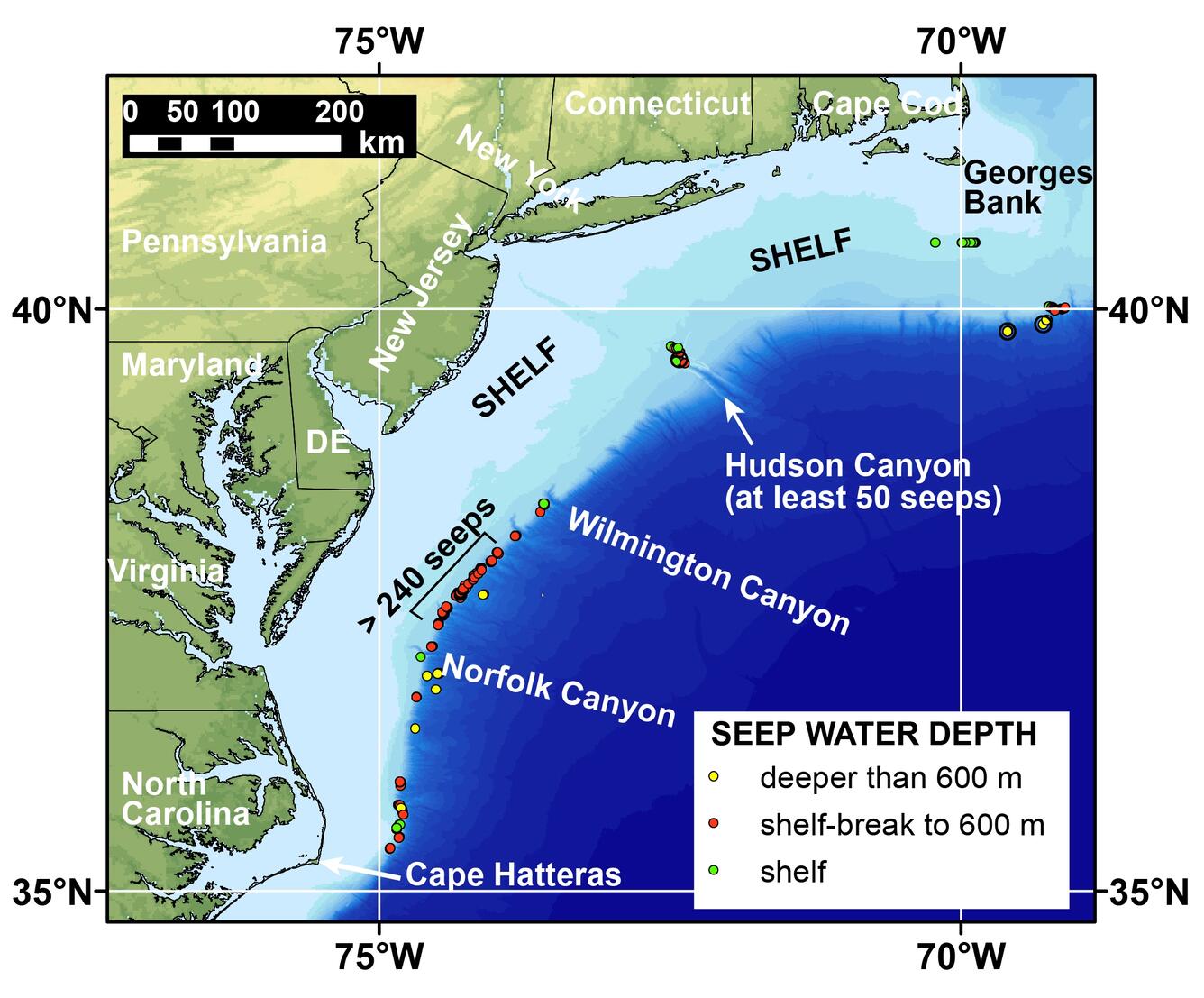
Map of the northern US Atlantic margin showing the locations of newly-discovered methane seeps

Detailed Description
Map of the northern US Atlantic margin showing the locations of newly-discovered methane seeps mapped by researchers from Mississippi State University, the US Geological Survey, and other partners. None of the seeps shown here was known to researchers before 2012.
Sources/Usage
Related

Gas Hydrates- Atlantic Margin Methane Seeps
Analysis of 94,000 square kilometers of multibeam water column backscatter data collected by the NOAA Okeanos Explorer mostly seaward of the shelf-break on the northern US Atlantic margin reveals more than 570 gas plumes that correspond to seafloor methane seeps. This discovery is documented in an August 2014 Nature Geoscience paper entitled, "Widespread methane leakage from the seafloor on the...
Related
Gas Hydrates- Atlantic Margin Methane Seeps
Analysis of 94,000 square kilometers of multibeam water column backscatter data collected by the NOAA Okeanos Explorer mostly seaward of the shelf-break on the northern US Atlantic margin reveals more than 570 gas plumes that correspond to seafloor methane seeps. This discovery is documented in an August 2014 Nature Geoscience paper entitled, "Widespread methane leakage from the seafloor on the...