
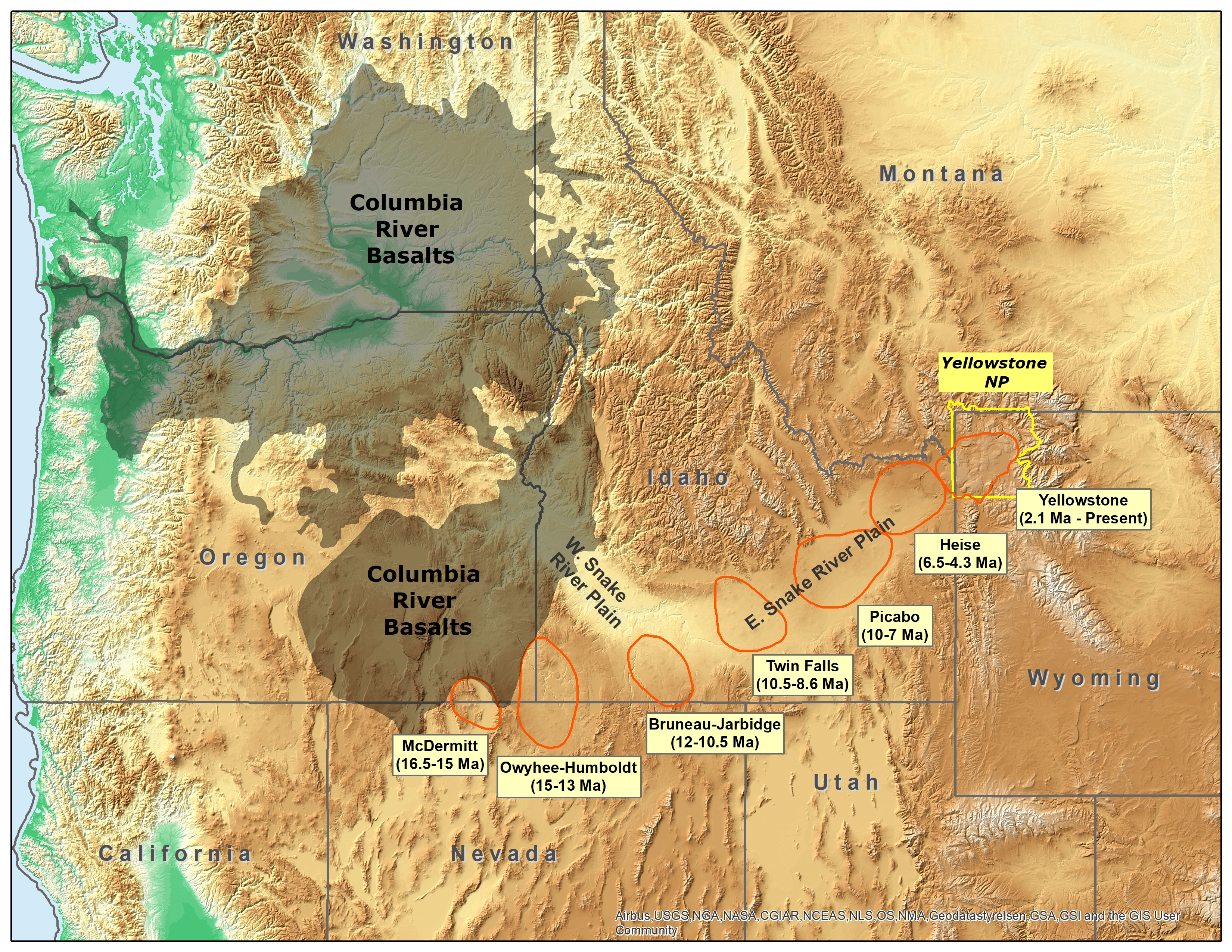
Map of the northwestern U.S., showing the approximate locations of Yellowstone h

Detailed Description
Map of the northwestern U.S., showing the approximate locations of Yellowstone hotspot volcanic fields (orange) and Columbia River Basalts (gray). Boundary of Yellowstone National Park is shown in yellow. Modified from Barry et al. (GSA Special Paper 497, p. 45-66, 2013), Smith and Siegel (Windows into the Earth: the geologic story of Yellowstone and Grand Teton National Parks: Oxford University Press, 2000), and Christiansen (USGS Professional Paper 729-G, 2001).
Sources/Usage
Public Domain.