
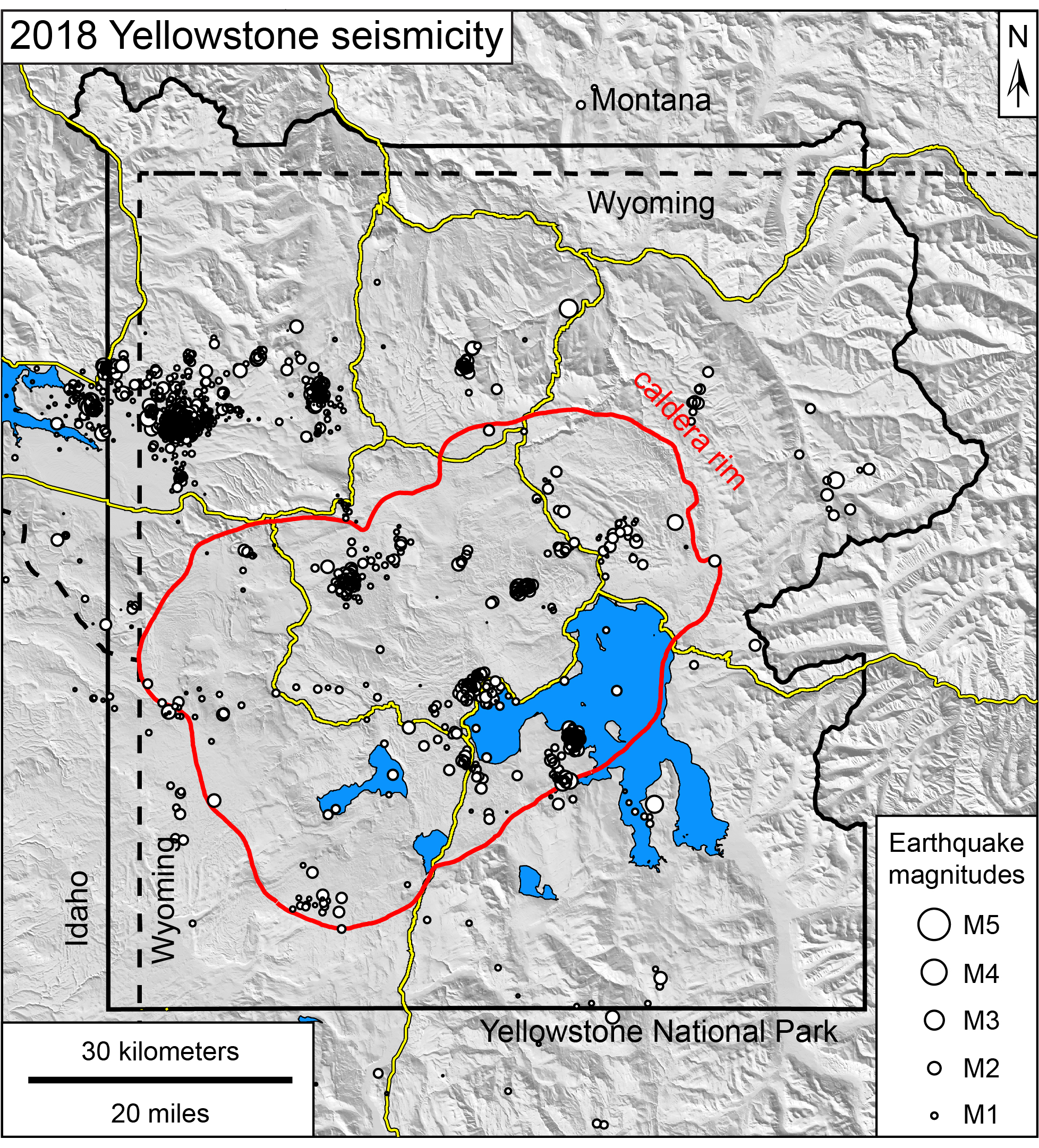
Map of seismicity in the Yellowstone region during 2018

Detailed Description
Map of seismicity (white circles) in the Yellowstone region during 2018. Yellow lines are roads, red line shows the caldera boundary, Yellowstone National Park is outlined in black, and dashed lines denote state boundaries.
Sources/Usage
Public Domain.