
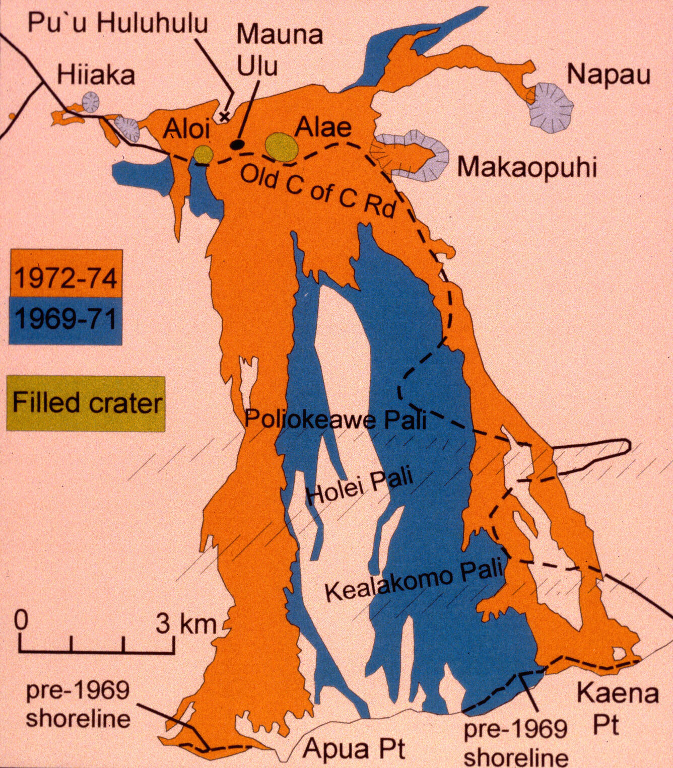
Map showing area covered by lava flows of Mauna Ulu eruption.
By Volcano Hazards Program
1905 (approx.)
Detailed Description
Map showing area covered by lava flows of Mauna Ulu eruption. Note that the map was made in 1997, before diacritical marks were being used in Hawaiian place names. The two colors designate the 1969-71 and 1972-1974 parts of the eruption, respectively. In the scale, 3 km is equal to about 2 mi.