
Map showing Island of Hawai‘i earthquake activity over the past week

Detailed Description
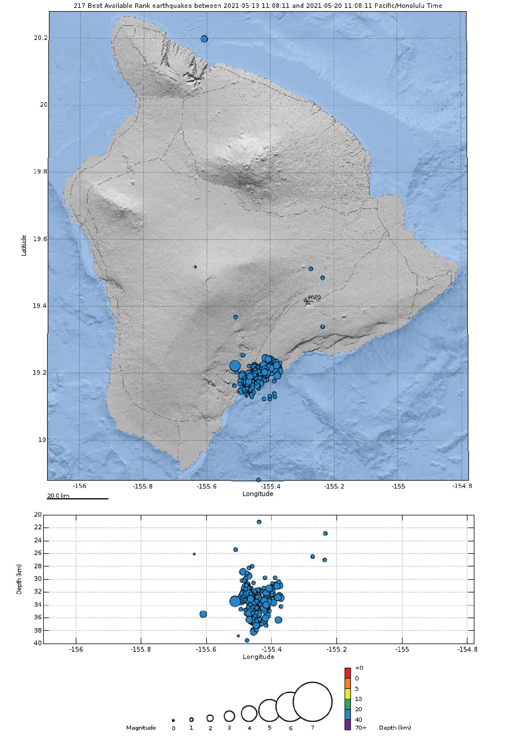
Map and plot showing earthquakes at 20-40 km (12-25 miles) depth beneath the Island of Hawai‘i over the past week. Most of the earthquakes at this depth were clustered beneath the southern edge of the island near the town of Pāhala (blue dots). USGS graphic.
Sources/Usage
Public Domain.