
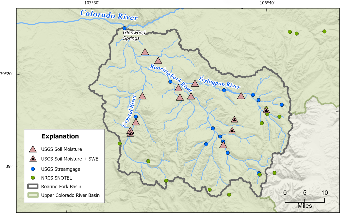
Map of the USGS cosmic-ray neutron sensor (CRNS) Roaring Fork Basin soil moisture monitoring network
Detailed Description
Map of the USGS cosmic-ray neutron sensor (CRNS) Roaring Fork Basin soil moisture monitoring network showing locations of USGS soil moisture and snow water equivalent (SWE) stations, USGS streamgages, and Natural Resources Conservation Service (NRCS) Snow Telemetry (SNOTEL) stations. Data collected at these stations are being used by the USGS to evaluate soil-moisture monitoring technology. To learn more, visit the CRNS research page.
Sources/Usage
Public Domain.
Related
Next Generation Water Observing System (NGWOS) - Advancing Soil Moisture Monitoring
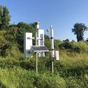
Soil moisture is an important part of the climate system, but it remains difficult to measure accurately. In 2022, the U.S. Geological Survey (USGS) began building a soil moisture monitoring network to provide high-quality continuous soil moisture data, standardize data collection methods, and test new technologies. Stations are placed in different climates and land cover types to capture a broad...
Related
Next Generation Water Observing System (NGWOS) - Advancing Soil Moisture Monitoring
Soil moisture is an important part of the climate system, but it remains difficult to measure accurately. In 2022, the U.S. Geological Survey (USGS) began building a soil moisture monitoring network to provide high-quality continuous soil moisture data, standardize data collection methods, and test new technologies. Stations are placed in different climates and land cover types to capture a broad...