
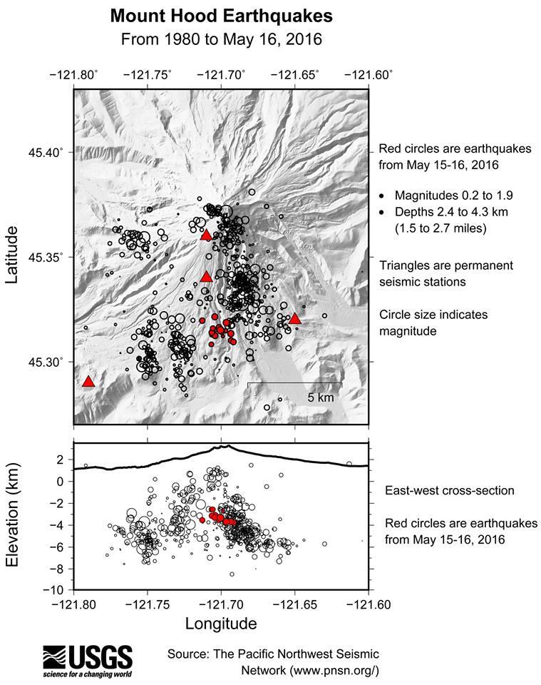
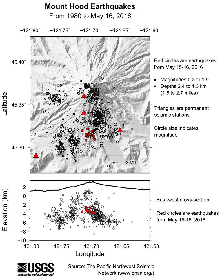
Map view of earthquakes (circles) near Mount Hood between 1980 and ...
Detailed Description
(Upper) Map view of earthquakes (circles) near Mount Hood between 1980 and May 16, 2016 from the Pacific Northwest Seismic Network. Earthquakes are sized based on their magnitude. Only earthquakes with 6 or more phase picks, a gap between seismic station observations of less than 150 degrees and a station within 5 km of the epicenter. Red triangles are permanent seismic stations as of 2016.
(Lower) East-West cross-section view of earthquakes plotted in map view.