
Mapping thermal input to Fern Lake, Yellowstone National Park, using satellite imagery

Detailed Description
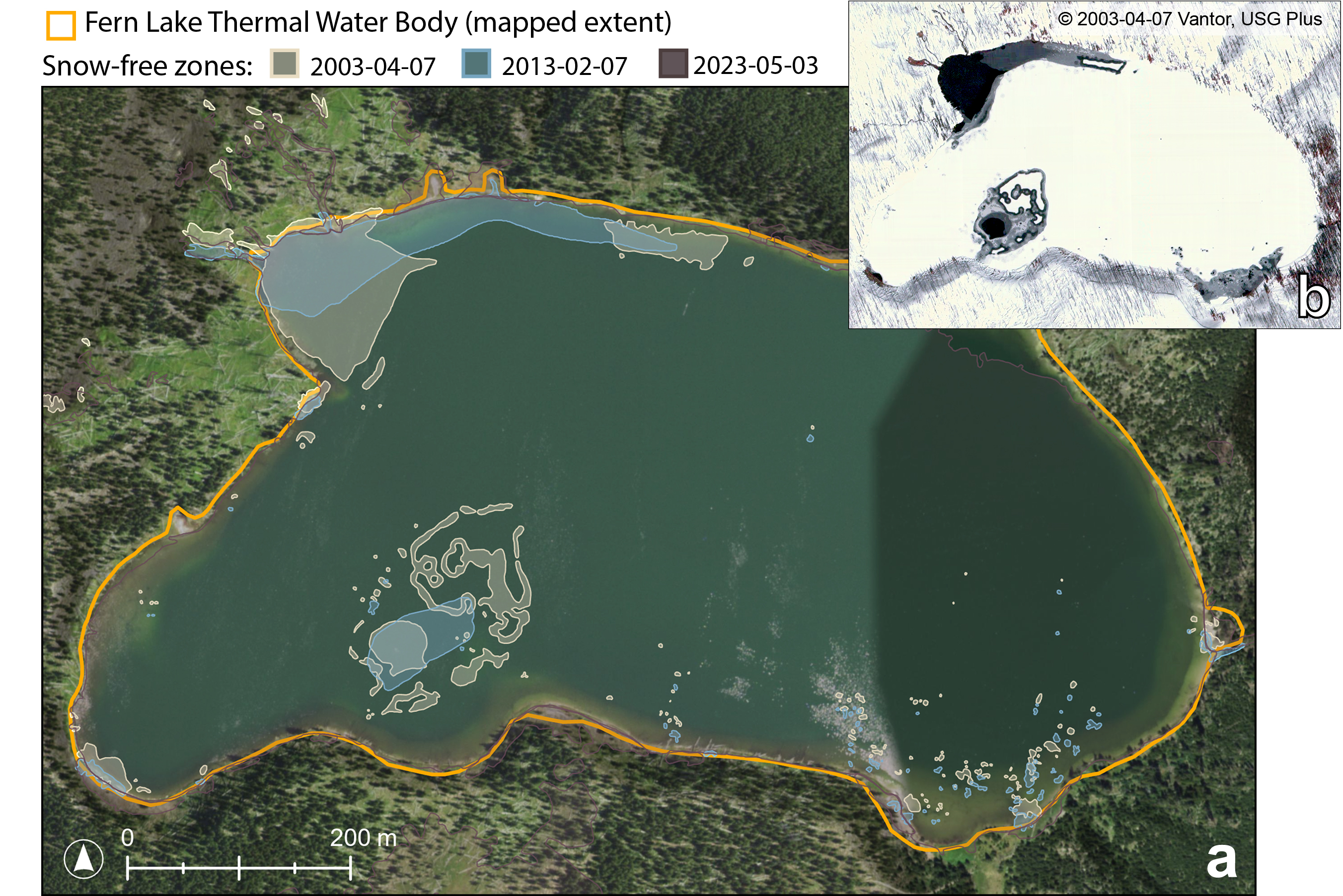
(a) NAIP (National Agriculture Imagery Program) natural-color aerial photograph of Fern Lake, in the east part of Yellowstone National Park, from July 17, 2022, showing mapped locations of liquid water during the winter when the rest of the water body was iced over. The mapped boundary of the lake is indicated by the orange outline, with shaded areas noting regions of no ice during winter imagery acquired on specific dates. Mapping these locations across winter seasons can show areas of the lake that may be receiving warm water inflow or the presence of underwater thermal features. (b) Example of color infrared image from QuickBird-2 acquired on April 7, 2003, used to map snow-free zones for Fern Lake.] Satellite images provided by Vantor (formerly Maxar Technologies) through their End User License Agreement via the NASA Commercial SmallSat Data Scientific Analysis (CSDSA) Program.
Sources/Usage
Public Domain.