
Maps of average recharge and change in snow water equivalent
Detailed Description
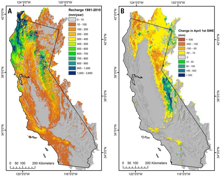
Figure 1. Maps of hydrologic output variables for (A) average recharge (net infiltration below the root zone) for water years 1981-2010 and (B) change in average April 1st snow water equivalent (SWE) between 1951-1980 and 1981-2010 calculated by the Basin Characterization Model for the California hydrologic region.
Sources/Usage
Public Domain.