
Maps showing China Camp Marsh study area with inset showing suspended sediment measurements
Detailed Description
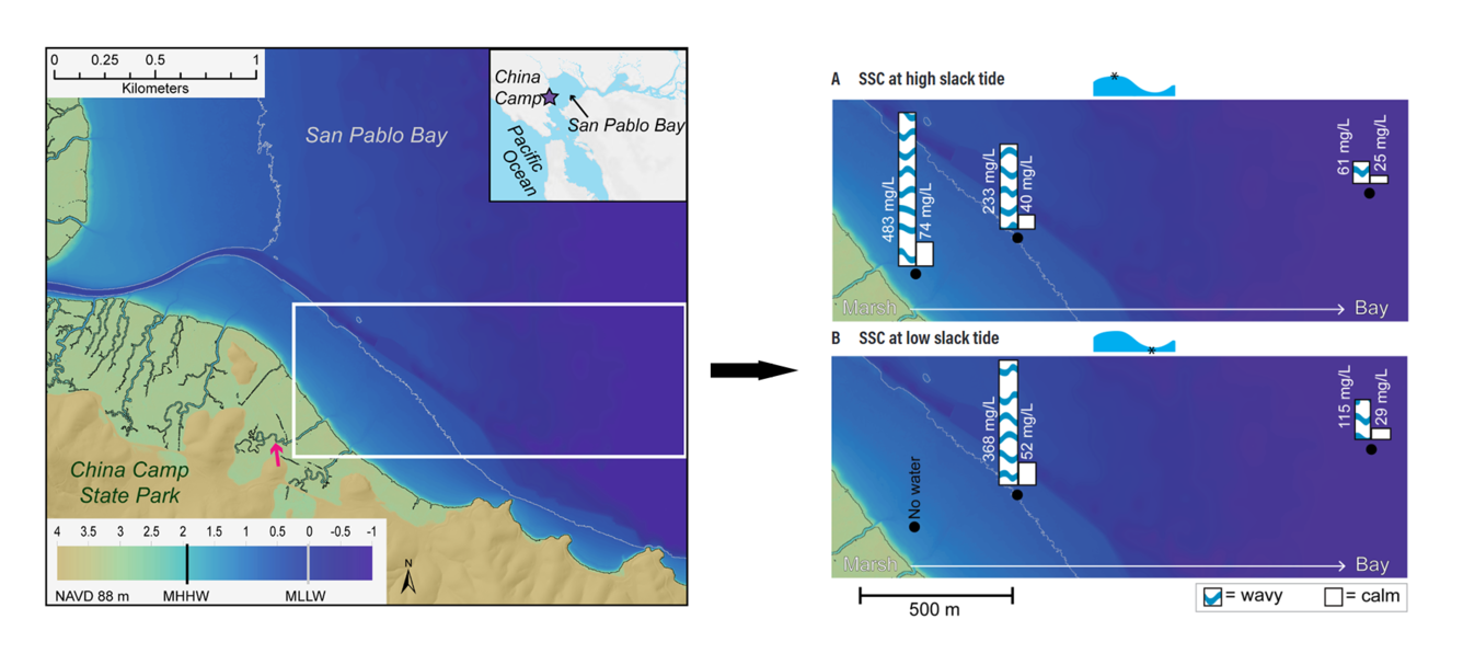
Map of study area: China Camp State Park and the adjacent shallows of San Pablo Bay. Black and gray bathymetry lines indicate the location of mean higher high water (MHHW) and mean lower low water (MLLW), respectively. Elevations in meters of those tidal datums are referenced to the North American Vertical Datum of 1988
(NAVD 88). The white box is the area shown on the right: Discrete measurements of suspended-sediment concentration (SSC in mg L– 1) at three locations (black dots) in the bay shallows at (A) high tide and (B) low tide during both a wavy condition (30-cm wave height at the farthest offshore station) and a calm condition (6-cm wave height at the farthest offshore station). Background color shows bathymetry. Black and gray bathymetry lines indicate mean higher high water (MHHW) and mean lower low water (MLLW), respectively. From the study Marsh Sediment in Translation: A Review of Sediment Transport Across a Natural Tidal Salt Marsh in Northern San Francisco Bay.
Sources/Usage
Public Domain.