
Mass balance, glacier coverage, and glacier hypsometry at Kahiltna and Kennicott Glaciers
Detailed Description
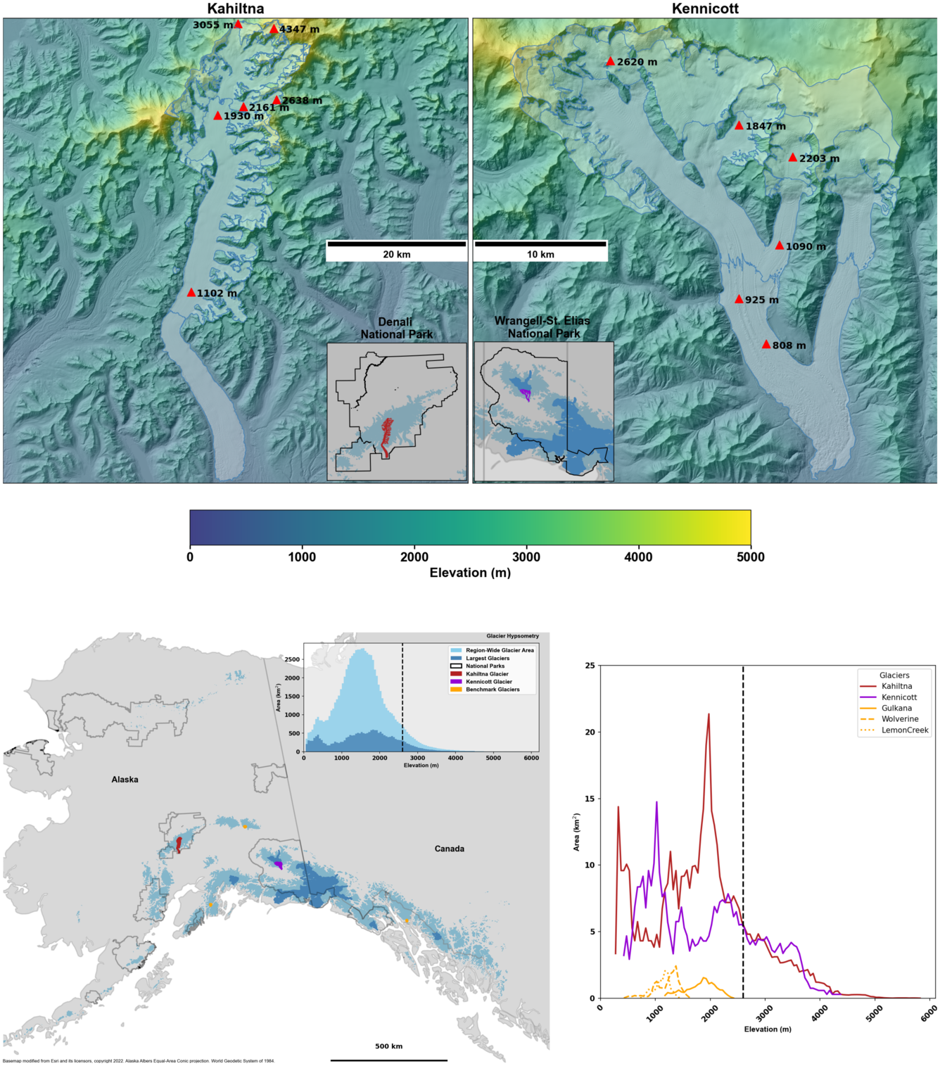
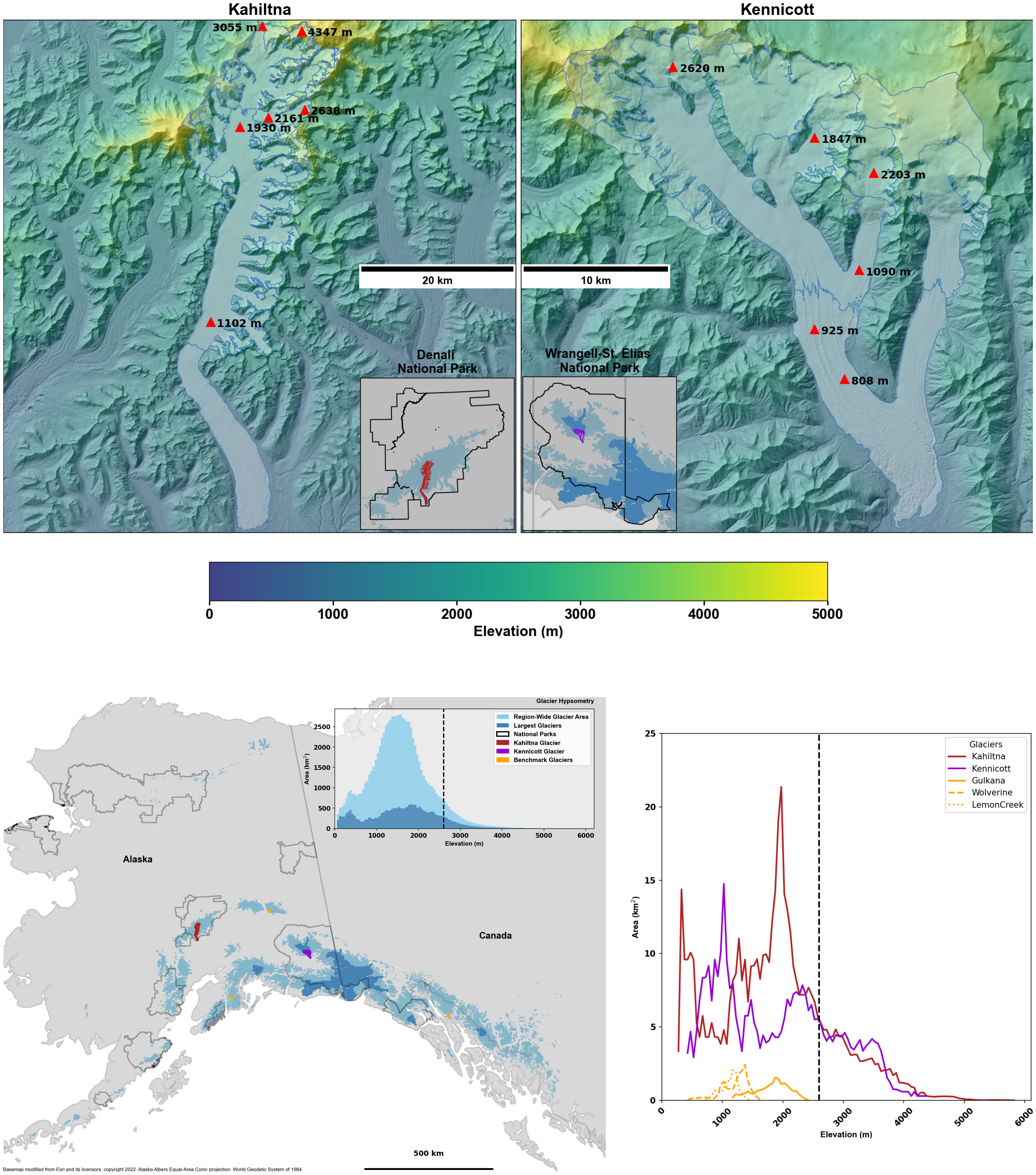
Top panel shows the location of mass balance sites on Kahiltna Glacier (left) and Kennicott Glacier (right). The bottom left panel shows Glacier distribution and National Park Service boundaries in Alaska. Glacier coverage (RGI Consortium 2017) shaded blue with the 100 largest glaciers shown in dark blue. The inset shows glacier hypsometry (distribution of area versus elevation) of the total glacier area and the dashed vertical line at 2,600 m. Bottom right panel shows individual glacier hypsometries (distribution of area versus elevation) for Kahiltna Glacier in red, Kennicott Glacier in purple, and the USGS Benchmark Glaciers in Alaska in gold. The vertical dashed line is at 2,600 m, the approximate base of the percolation zone.
Sources/Usage
Public Domain.
Related

Glaciers and Landscape Change

Additional Research Glaciers
Related
Glaciers and Landscape Change