
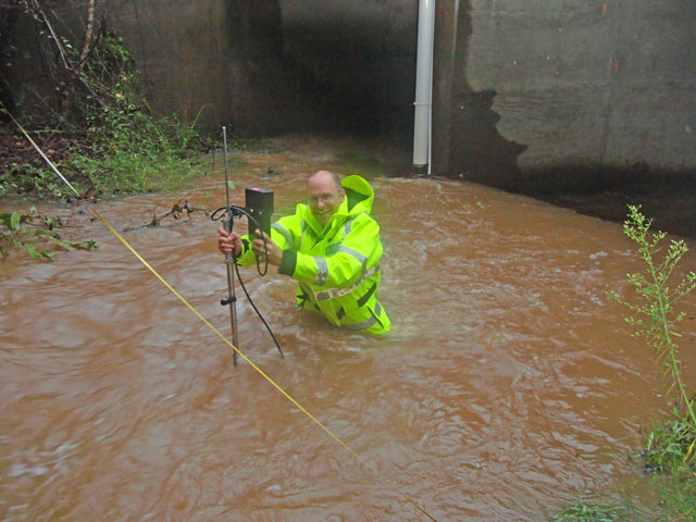
Measuring streamflow, Wheeler Creek at Bill Cheek Rd, near Auburn, Ga.

Detailed Description
Measuring Streamflow During a High-Water Event
September 2009 Flooding
Wheeler Creek at Bill Cheek Rd, near Auburn, Georgia (02217274)
Here, a U.S. Geological Survey hydrographer is measuring streamflow at Wheeler Creek. He is holding a wading rod that has a current meter attached to it. The current meter is used to measure water velocity at various vertical depths. The hydrographer makes these measurements at a number of locations horizontally across the stream and from these measurements can produce a value of streamflow in cubic feet per second.
Wheeler Creek at Bill Cheek Rd. Stream stage was 3 feet, corresponding to about 120 cubic feet per second (cfs). These small tributary streams, typically are ungaged and rise and fall quickly during storms so, it is important to measure streamflow at these sites during flooding. A streamflow of 120 cfs puts this measurement in the top 10 flows for the period of record for this site.
Sources/Usage
Related

The Streamgaging Program in the South Atlantic Water Science Center
Related