
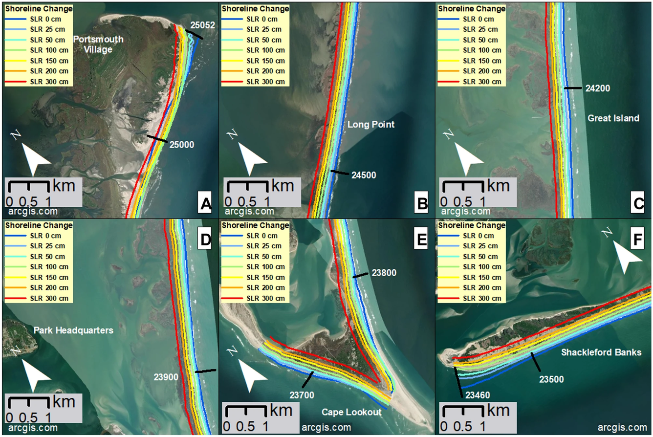
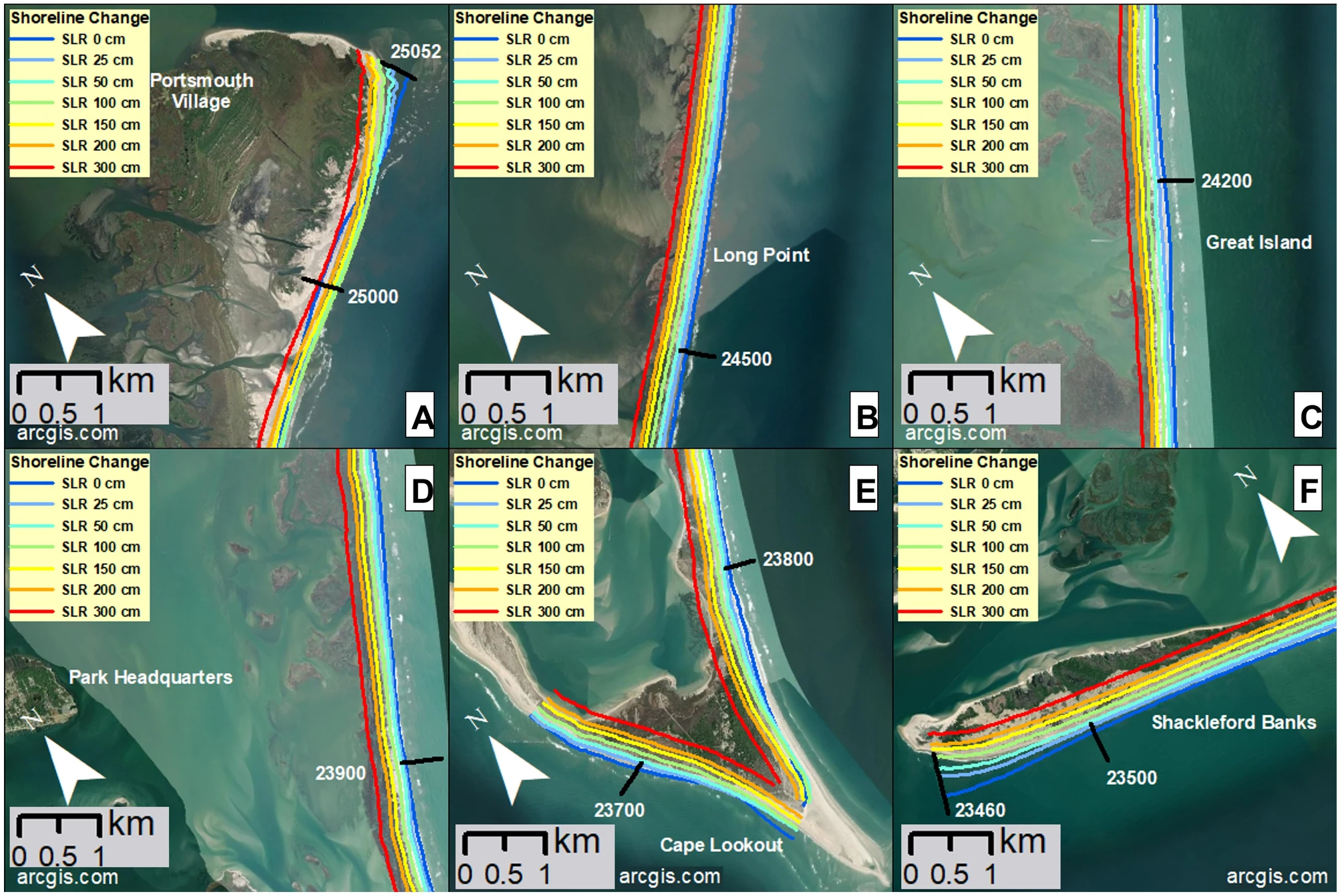
Modeled shoreline change projections at Cape Lookout National Seashore
Detailed Description
Modeled shoreline change projections overlayed onto maps of some key areas of Cape Lookout National Seashore. Note that the reference shoreline position from 1990 is not shown. Panel (A) shows the shoreline near the historic Portsmouth Village, at the northern extent of the islands, including a ferry terminal. Panels (B) and (C) show camp areas Long Point and Great Island, respectively, each including a ferry terminal. Panel (D) shows the barrier island that is oceanward of Harkers Island, the Park Headquarters location. Panel (E) shows Cape Lookout, which includes a ferry terminal, the Cape Lookout Lighthouse, just north of transect 23,800, and a historic U.S. Coast Guard Station. Panel (F) shows the western end of Shackleford Banks, including a ferry terminal.
Sources/Usage
Public Domain.