
Rising Seas and Stronger Storms Threaten Barrier Island Systems
A new study led by USGS models projected overland flooding, groundwater depth, shoreline change, and vertical land motion at Cape Lookout National Seashore in North Carolina, finding that rising sea levels and shifting storm patterns will make barrier island systems like Cape Lookout increasingly vulnerable to coastal hazards over the coming decades.
As sea levels rise and storms intensify, these narrow stretches of sand and vegetation that buffer coastlines will be exposed to more frequent and severe flooding, erosion, and water table changes.
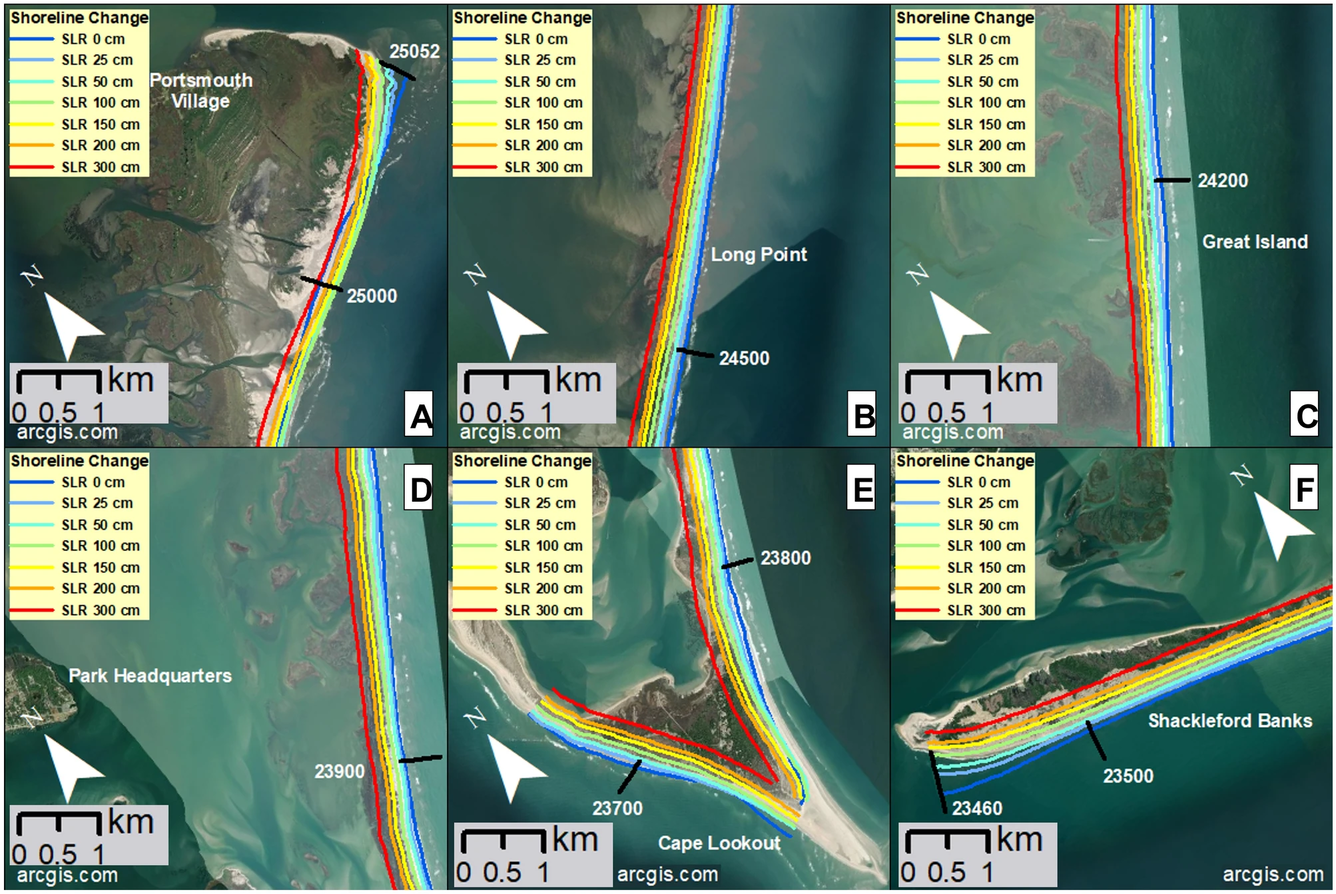
The study’s findings, focusing on Cape Lookout, project that with a sea-level rise (SLR) of just 0.5 meters, nearly half of the current land area of the islands will flood daily, with the impact worsening during storms. Even a moderate one-year storm could flood up to 74% of the barrier island area, while more powerful storms with a 20-year return interval could submerge more than 85% of the islands.
In addition to flooding, shallow and emerging groundwater poses a growing challenge, as the water table across the islands is already shallow—often less than two meters deep. As sea levels continue to rise, groundwater will rise as well, reaching the land surface in many locations, increasing the risk of flooding from within. The islands are also retreating at alarming rates: with a projected one-meter rise in sea levels, shoreline retreat could average 178 meters, which is more than 60% of the island width at its narrowest points.
Related commentary: Transdisciplinary research supports the sustainability of barrier island systems threatened by climate change
Compounding the impacts of SLR and storms, subsidence—where parts of the land slowly sink—exacerbates these issues. One third of Cape Lookout National Seashore is currently subsiding at a rate of more than two millimeters per year, accelerating erosion and habitat loss.
These trends present significant challenges for park managers and others who oversee natural barrier systems such as Cape Lookout. Tasked with both preserving natural ecosystems and protecting cultural heritage sites, they face mounting pressure to balance the needs of human safety and environmental preservation in a landscape increasingly shaped by climate change. This study highlights the urgent need for long-term planning and adaptive management to mitigate the escalating hazards facing barrier island systems around the world.
Listen to the National Parks Traveler podcast episode "Keeping Cape Lookout Above Water", featuring study authors Jennifer Thomas and Patrick Barnard.
Related

Coastal Storm Modeling System (CoSMoS)

CoSMoS-COAST
Related
Coastal Storm Modeling System (CoSMoS)