
Most recent Mauna Loa Northeast Rift Zone eruption map
Detailed Description
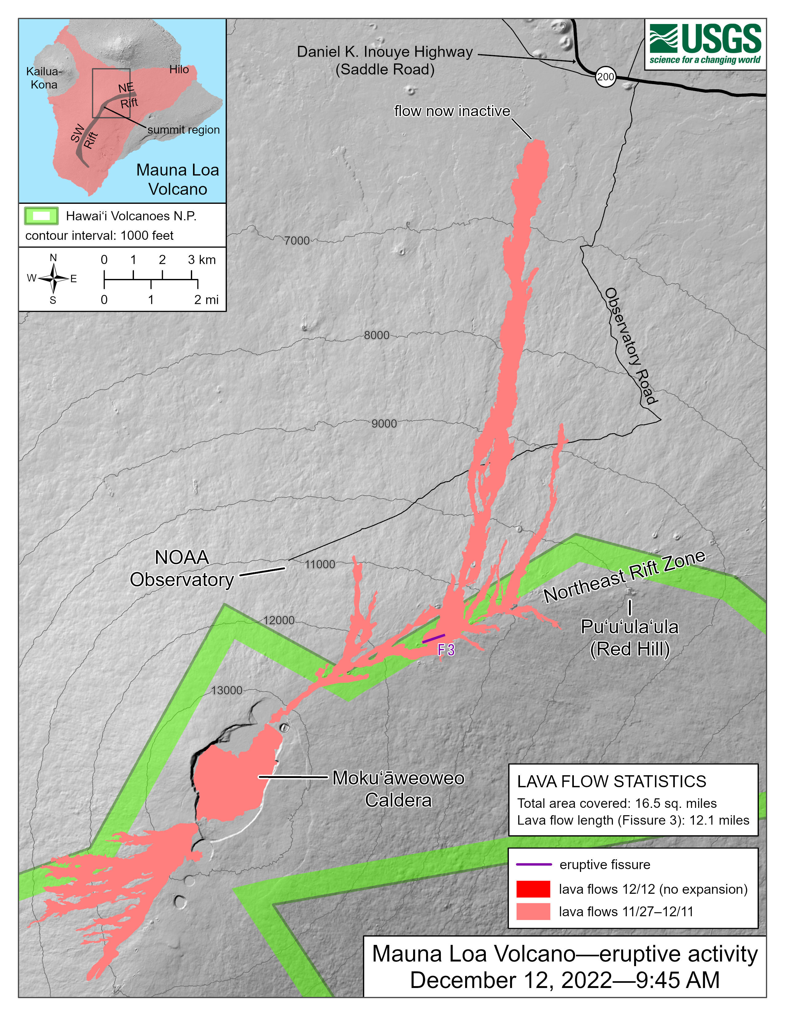
The Northeast Rift Zone eruption of Mauna Loa continues. One active fissure, fissure 3, is feeding a lava flow downslope to the north. HVO field crews and USGS analysts have accurately mapped some of the most active flows, displayed in red here, along with older flows further uprift, in part of Mokuʻāweoweo Caldera, and in the upper summit region southwest of the caldera.
Sources/Usage
Public Domain.