
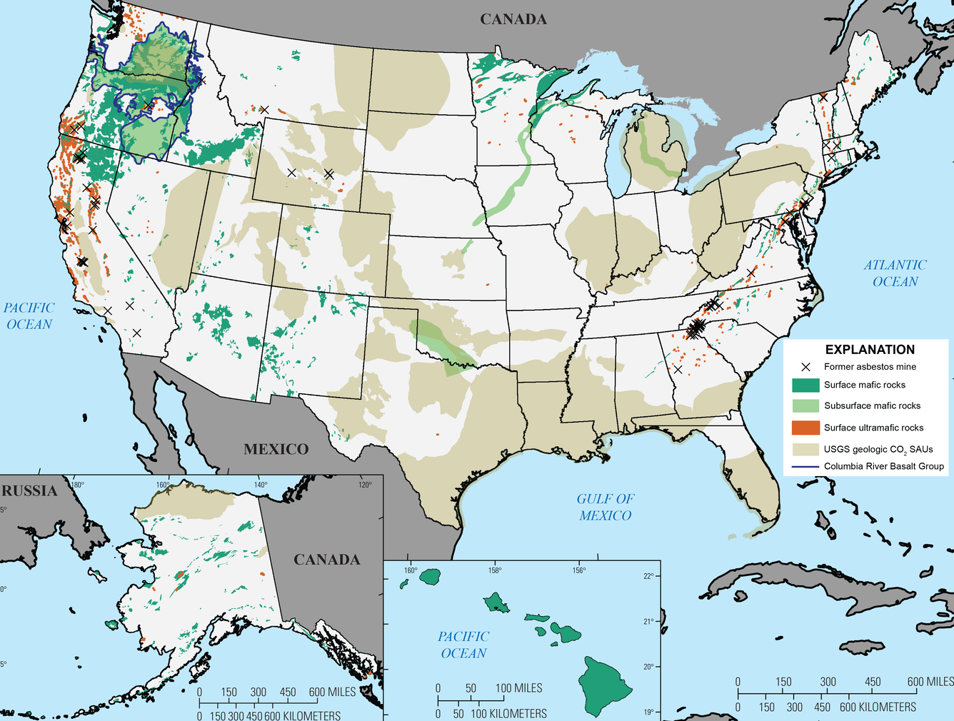
National map of mafic and ultramafic rocks in the United States
Detailed Description
National map of mafic and ultramafic rocks in the United States
Modified from figure 1 in: Blondes, M.S., Merrill, M.D., Anderson, S.T., and DeVera, C.A., 2019, Carbon dioxide mineralization feasibility in the United States: U.S. Geological Survey Scientific Investigations Report 2018–5079, 29 p., https://doi.org/10.3133/ sir20185079.
Geologic data were compiled and, in some instances, simplified from Lambert and others (1988), Ojakangas and others (2001), Reed and others (2005), Sherrod and others (2007), Garrity and Soller (2009), Krevor and others (2009), and Barry and others (2013). Outlines of ultramafic-rock polygons were used to increase visibility. Asbestos mines were compiled from past producing mines described in Van Gosen (2006a,b; 2007a; 2008; 2010) and Van Gosen and Clinkenbeard (2011). U.S. Geological Survey (USGS) geologic carbon dioxide (CO2) storage assessment units (SAUs) were defined in the USGS national assessment of geologic CO2 storage resources (U.S. Geological Survey Geologic Carbon Dioxide Storage Resources Assessment Team, 2013) to estimate CO2 storage potential in saline reservoirs within sedimentary basins. The western Aleutian Islands in Alaska that do not contain relevant rock types are not shown. Base map was compiled from data from Environmental Systems Research Institute, Inc. (2007a,b) and Jarvis and others (2008).
Sources/Usage
Public Domain.