
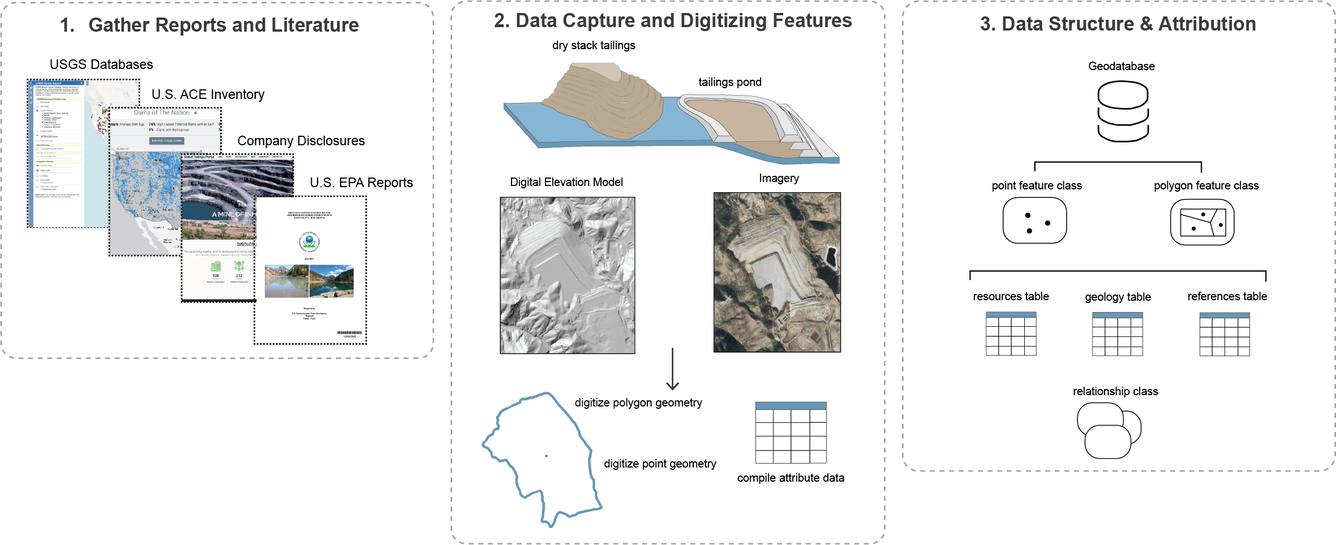
National Mine Waste Inventory Workflow Schematic
Detailed Description
Schematic diagram showing how mine waste features were captured and attributed as part of their inclusion in the new National Mine Waste Inventory data release (https://doi.org/10.5066/P148EEUA).
Sources/Usage
Public Domain.
Related

USMIN Mineral Deposit Database
The USMIN Mineral Deposit Database Project develops national-scale geospatial databases that provide authoritative information on the most significant mines, mineral deposits, and mining districts in the United States. These resources advance the understanding of domestic mineral resources and are available through the output of digital data products, journal articles, presentations, and other...
USMIN: National Mine Waste Inventory
USMIN, in partnership with the USGS Earth Mapping Resources Initiative, collaborates with state geological surveys to compile a national inventory of mine waste features in the United States. This effort supports resource recovery, environmental risk management, and identification of critical minerals in mine waste.
Related
USMIN Mineral Deposit Database
The USMIN Mineral Deposit Database Project develops national-scale geospatial databases that provide authoritative information on the most significant mines, mineral deposits, and mining districts in the United States. These resources advance the understanding of domestic mineral resources and are available through the output of digital data products, journal articles, presentations, and other...
USMIN: National Mine Waste Inventory
USMIN, in partnership with the USGS Earth Mapping Resources Initiative, collaborates with state geological surveys to compile a national inventory of mine waste features in the United States. This effort supports resource recovery, environmental risk management, and identification of critical minerals in mine waste.