
Natural Bridges - The Moki Dugway
Detailed Description
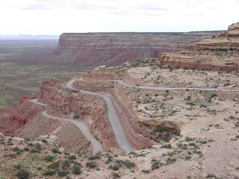
The Moki Dugway is a gravel road, part of Highway 26, about 24 miles south of Natural Bridges National Monument. This view shows the tight switchbacks and steep grade of the dugway road that climbs the southern escarpment of Cedar Mesa. Moki Dugway was built in 1958 for trucks hauling uranium ore. The ancient inhabitants of this region had no such "highway" for travelling up and down the mesa. Carved hand- and foot-holds and worn step-like paths of ancient American Indians can be found leading up cliffs and steep escarptments to food storage areas, dwellings, springs, or up steep escarpments like the one shown here. The Cedar Mesa Sandstone of Early Permian age forms cliffs and the cap rock rim of the mesa. The lower slopes consist of softer sandstones, siltstones and shales of the Halgaito Formation of Late Pennyslvanian age. The valley below is underlain by an older marine sedimentary formation, the Honaker Trail Formation of Late Pennsylvanian age. The Honaker Trail Formation is exposed in the valley of the San Juan River along the northern boundary of the Navajo Reservation (Stevenson, 2000).
Sources/Usage
Public Domain.