
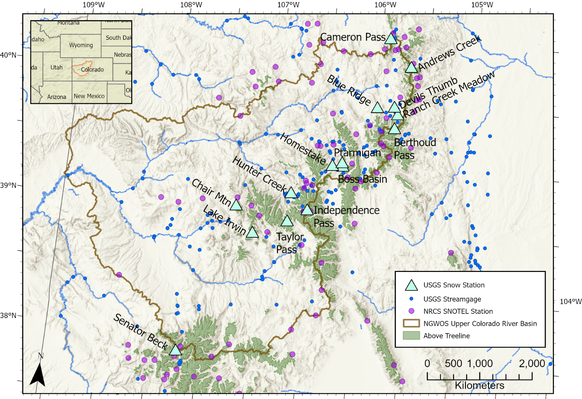
NGWOS site location map

Detailed Description
Map of the Upper Colorado River Basin showing locations of USGS snow stations, USGS streamgages, and Natural Resources Conservation Service (NRCS) Snow Telemetry (SNOTEL) stations.
Sources/Usage
Public Domain.
Related
Next Generation Water Observing System (NGWOS) Snow Hydrology Monitoring Network in the Upper Colorado River Basin
Representative observations of snowpack conditions are vital for informing water availability assessments and modeling in snow dominated regions of the western United States. The U.S. Geological Survey (USGS) established a snow hydrology monitoring network in 2021 with the objective of providing high-quality, representative, and publicly available data on snowpack, soil moisture, and...