
NHD State Product Step 6, part 1: Utilize batch processing in the Append tool in ArcMap
Detailed Description
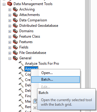
Utilize batch processing in the Append tool in ArcMap to combine each dataset’s feature classes and tables into one geodatabase. The USGS recommends appending to the lowest numbered HU. Both Hydrography and WBD feature datasets, as well as all tables, must be appended.
From: Create Your Own NHD State Product | U.S. Geological Survey (usgs.gov)
Sources/Usage
Public Domain.