
Oblique lidar shaded relief image of the Gros Ventre Slide, Wyoming
Detailed Description
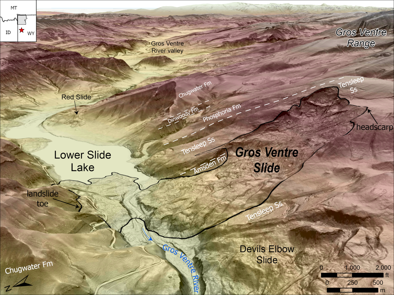
Oblique lidar shaded relief map looking east up the Gros Ventre River valley, Wyoming. The Gros Ventre Slide, which occurred on June 23, 1925, is outlined in black, and it moved from the high ridge on the south (right side of image) into the valley below. North-dipping sedimentary rock units are labeled in white, separated by white dashed lines. The slope failed near the contact of the Tensleep Sandstone and the underlying Amsden Formation. Abundant rainfall and snowmelt during a particularly wet spring saturated weak layers at the base of the Tensleep Sandstone, where groundwater collects above the impermeable shales of the Amsden Formation. These saturated conditions lowered the frictional strength of the weak layers and set the stage for the landslide, which may have been triggered by a small earthquake. Other landslides are visible in the lidar image, including the prehistoric Devils Elbow Slide and the Red Slide, which occurred six days after the Gros Ventre Slide on Jun 29, 1925. (Lidar digital elevation models published in 2024 by the U.S. Geological Survey 3D Elevation Program and downloaded from https://apps.nationalmap.gov/downloader/.)
Sources/Usage
Public Domain.