
Ocean Carbon System in Gulf of America and Tampa Bay

Detailed Description
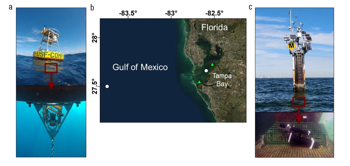
(A) Ocean Carbon System version 3 (OCSv3) located in the Gulf of America at COMPS C12 buoy. (B) Map of Tampa Bay and coastal Gulf of America with locations of OCS systems. White circles indicate locations of OCS systems. Green triangles indicate the mouths of the Little Manatee River to the northeast and the Manatee River to the southwest of the OCSv2 system. (C) Ocean Carbon System version 2 (OCSv2) located in lower-middle Tampa Bay at PORTS station.
Sources/Usage
Public Domain.
Map image is the intellectual property of Esri and is used herein under license. Copyright © 2021 Esri and its licensors. All rights reserved.
Satellite imagery base layer accessed at https://services.arcgisonline.com/ArcGIS/rest/services/World_Imagery/Ma…. Map image is the intellectual property of Esri and is used herein under license. Copyright © 2021 Esri and its licensors. All rights reserved.