
October 8, 2021 — Kīlauea, Halema‘uma‘u Lava Lake Growth

Detailed Description
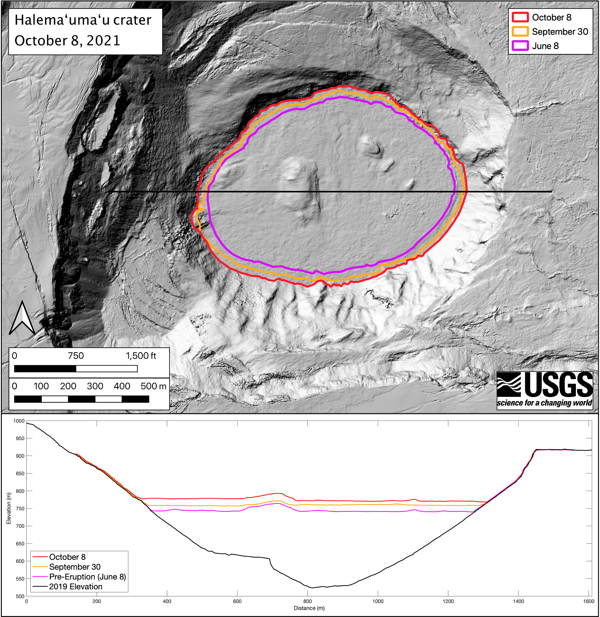
The eruption within Halema‘uma‘u crater, at Kīlauea's summit, continues to feed a growing lava lake. Photos taken during helicopter overflights of the crater allow HVO scientists to create elevation maps of the rising lake’s surface. The surface area of the Halema‘uma‘u lava lake is now 553000 square meters, or 157 acres. At its widest point, the lake is a kilometer wide (0.62 miles). The colored lines in the top map show the perimeter of the lake prior to the recent eruption (pink, data from June 8), one day into the eruption (orange, September 30), and over a week into the eruption (red, October 8). Since the eruption began on September 29, surface area has increased by 20%. This map shows the topography of the lava lake surface on the morning of October 8. The bottom panel shows W-E elevation profiles of Halema‘uma‘u along the black line in the top map. The lava lake is now 260 m (850 ft) deep. The lake surface on October 8 (red line) averaged 29 m (95 ft) above the pre-eruption surface (pink line, data from June 8). Half of the lake surface rise during the eruption so far occurred in the first day of the eruption (orange line). The total erupted volume as of October 8 is 16 million cubic meters (4.2 billion gallons, or 6300 Olympic-size swimming pools), which is approximately 40% of the total volume from the December 2020-May 2021 summit eruption. USGS map by B. Carr.
Sources/Usage
Public Domain.