
October 8, 2021 — Kīlauea, Halema‘uma‘u Lava Lake Growth

Detailed Description
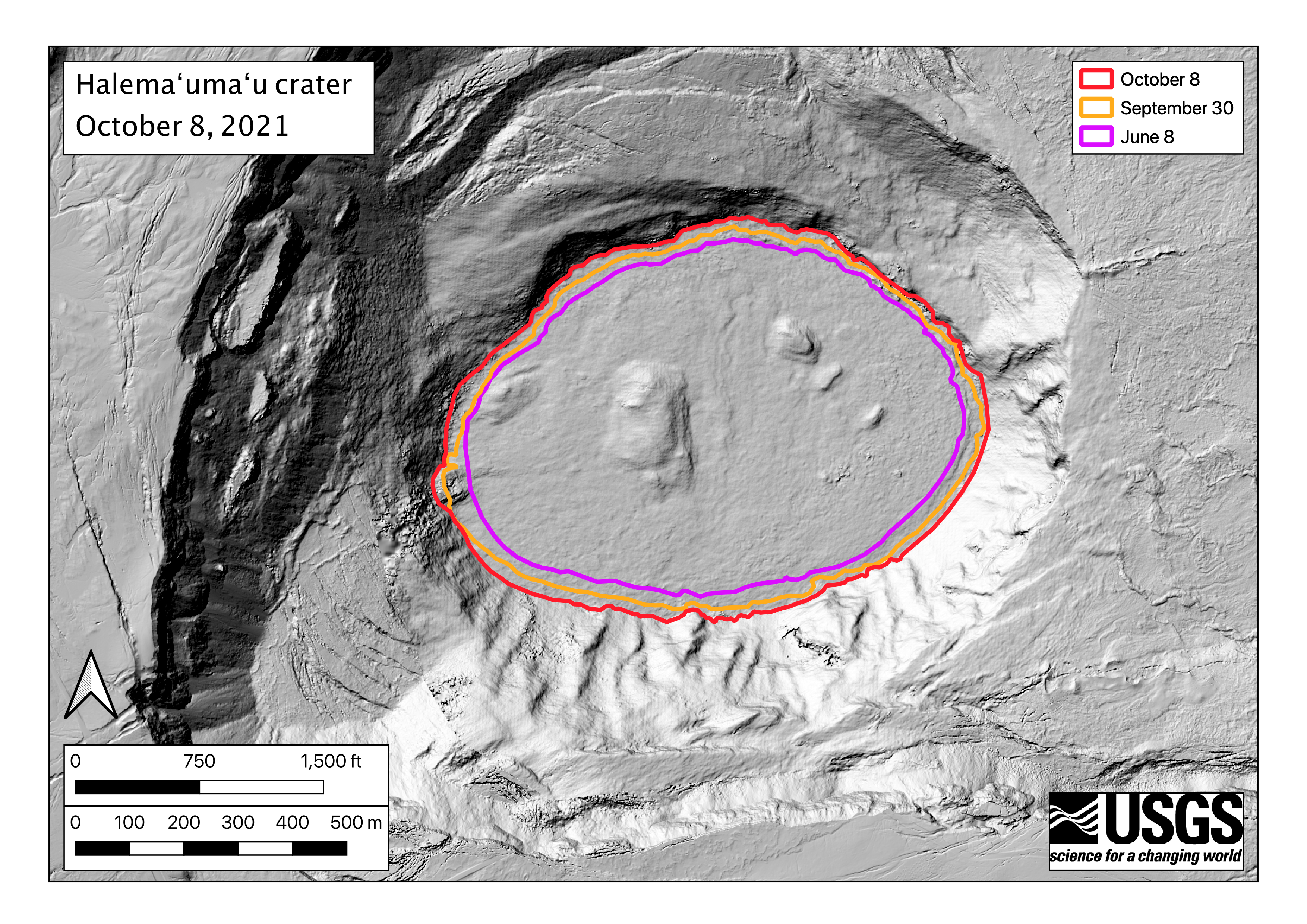
The surface area of the Halema‘uma‘u lava lake at the summit of Kīlauea is now 553,000 square meters, or 157 acres. At its widest point, the lake is a kilometer wide (0.62 mile). The colored lines show the perimeter of the lake prior to the recent eruption (pink, data from June 8), one day into the eruption (orange, September 30), and over a week into the eruption (red, October 8). Since the new eruption began on September 29, surface area has increased over 20%. The basemap in this figure shows the topography of the lava lake surface created by applying structure-from-motion photogrammetry to images taken during a helicopter overflight of Halema‘uma‘u on the morning of October 8. USGS map by B. Carr.
Sources/Usage
Public Domain.