
Peace Day and Kahauale‘a 2 flow fields

Detailed Description
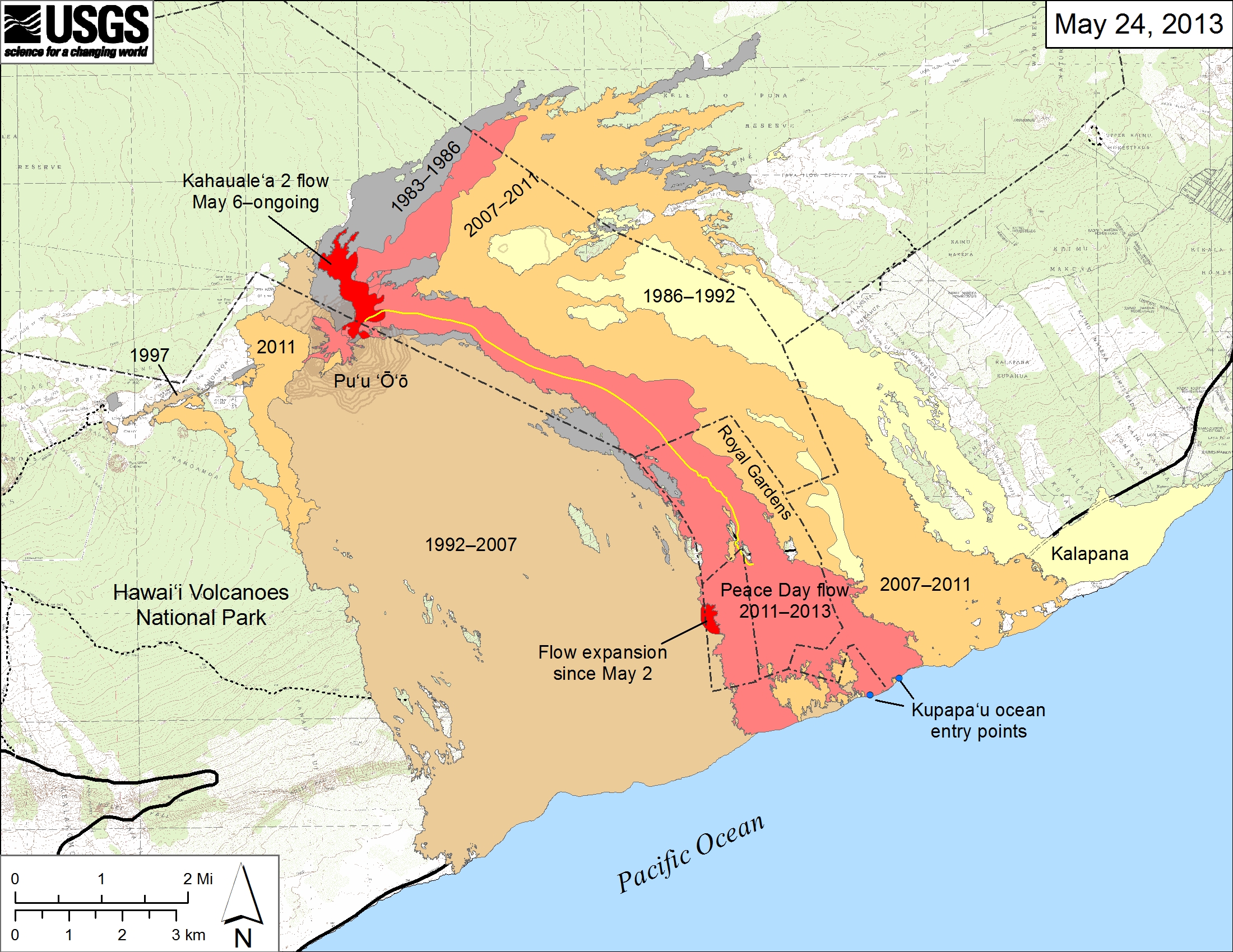
Small-scale map showing the active Peace Day flow, carrying lava to the ocean, and the active Kahauale‘a 2 flow north of Pu‘u ‘Ō‘ō, as of May 24, 2013. The Kahauale‘a 2 flow started on May 6 and continues to spread slowly at the base of Pu‘u ‘Ō‘ō Cone. Southeast of Pu‘u ‘Ō‘ō, breakouts near the base of the pali crept beyond the western edge of the Peace Day flow, widening that flow field and crossing into the National Park. The eastern Peace Day flow margin may have also changed near the coastline and mid-way up the pali, where small breakouts have persisted for weeks, but these areas were not mapped recently. Older lava flows are labeled with the years in which they were active. Episodes 1-48b (1983-1986) are shown in gray; episodes 48c-49 (1986-1992) are pale yellow; episodes 50-55 (1992-2007) are tan; and episodes 58-60 (2007-2011) are pale orange. The Peace Day lava tube is shown by the yellow line. The Peace Day tube where it crosses the coastal plain is not obvious and has not been mapped. The contour interval for topographic lines shown on Pu‘u ‘Ō‘ō is 5 m.